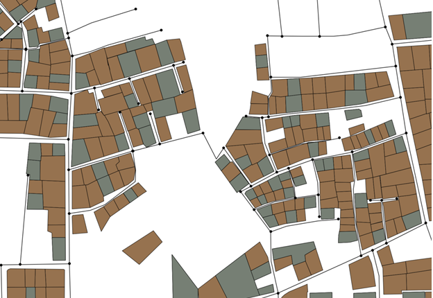
The image below is a representation of a digitised urban area derived from Google Satellite and OSM. The black lines between nodes are street segments and the irregular polygons are households.
I want to calculate the number of households along a street segment - the initial approach was to specify a buffer around each line segment in QGIS, and then use the 'Join attributes by location' to derive counts of households that fall within the buffer zone. However, I realise this is not a robust approach.
Is there an appropriate way of performing this calculation?

