9

I am on a committee looking to redesign transit service in Sacramento and need to be able to make equal-time maps or "isochrones," like the attached.

A prominent difference between transit isochrones and road isochrones:

  1. each transfer has a temporal penalty. That is, it takes time to wait for the connecting bus.
  2. that penalty is lower where the connecting routes are more frequent and higher where the connecting routes are less frequent.
  3. some routes only serve stations, while others are considered to have an even distribution of stops along their routes.

( I am interested in a hybrid model between frequency and coverage that still creates a high-frequency grid between major traffic generators, but with routes that take different branches between the generators. This offers both frequency and coverage. Currently, the debate is binary, frequency or coverage.)

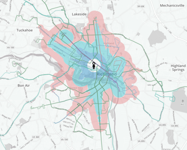
Transit Isochrone Example

3
  • What software do you have available? The answer you get will depend largely on that knowledge. Commented Jun 29, 2018 at 19:16
  • Have you got the budget to use google's transport API? You'd have to call it over a set of locations, different start times etc, but you can get point-to-point transport times via public transport.
    – Spacedman
    Commented Jun 29, 2018 at 19:36
  • Essential to this process is being able to compare the isochrones for different alignment of routes. That is, to not use existing routes. I am running QGIS under Linux. I also have Mathematica. Thanks! Commented Jun 30, 2018 at 22:53

2 Answers 2

2

You should give OpenTripPlanner's Analyst functions a shot.

There is a tutorial that will get you started here

Tutorial

0

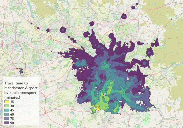
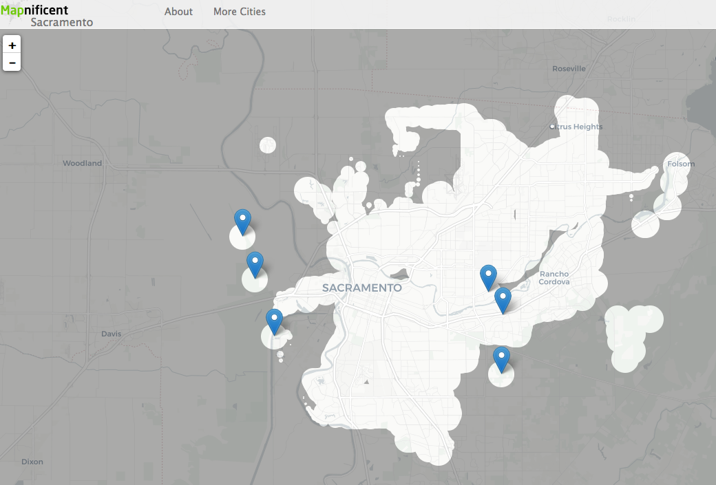
I'm not sure of the exact methodology used, but you might want to look at how Mapnificent was implemented (it's open source). This is based on the work done on Mapumental.

Here's the Sacramento one...

enter image description here

If you want to implement something like this yourself, you'll presumably need a dataset with timetables/transit times for transport nodes (in the UK this is called NaPTAN).

3
  • Not sure I believe the results of Mapnificent for Greater Manchester. the 90min area doesn't get the Lancaster and its only an hour on the train. Is this only buses?
    – Spacedman
    Commented Jun 29, 2018 at 19:34
  • i have no idea. it was just a suggestion for the the asker to look into :)
    – Steven Kay
    Commented Jun 29, 2018 at 19:41
  • Thank you Steven! Can you realign routes within Mapnificent to compare different networks? Commented Jun 30, 2018 at 22:55

Your Answer

By clicking “Post Your Answer”, you agree to our terms of service and acknowledge you have read our privacy policy.

Not the answer you're looking for? Browse other questions tagged or ask your own question.