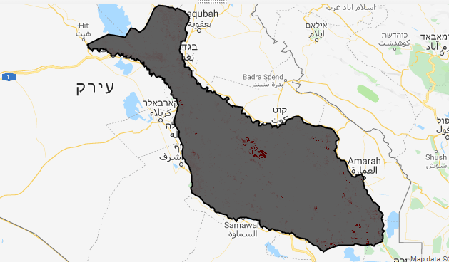
I have created images in google earth engine , when I work in the code editor platform it works and it has the right polygon shape but whenever I export it to my drive and download it, I don't get the full Image.
and this is what I get afterr exporting to drive -

this is the code I wrote;
var diff1=(period1.subtract(period2)).divide(period1);
var diff2=(period2.subtract(period3)).divide(period2);
var diff3=(period3.subtract(period4)).divide(period3);
var diff4=(period4.subtract(period5)).divide(period4);
var meandiff=(diff1.add(diff1).add(diff3).add(diff4)).divide(4);


var visDiff={min: 0, max: 1, palette: [
    'FFFFFF', '#ffcccc', '#ff8080', '#ff1a1a', '#e60000'
  ]};

Map.centerObject(period1,7);
Map.addLayer(diff1,visDiff,'Diff periods1-2');
Map.addLayer(diff2,visDiff,'Diff periods2-3');
Map.addLayer(diff3,visDiff,'Diff periods3-4');
Map.addLayer(diff4,visDiff,'Diff periods4-5');
Map.addLayer(meandiff,visDiff,'18Years');

 var toexport = diff3.visualize(visDiff)


// Export the image, specifying scale and region.
Export.image.toDrive({
  image: toexport,
  description: 'diff3',
  scale: 500,

});
any idea what can be the problem?


regionargument inExport.image.toDrivefunction