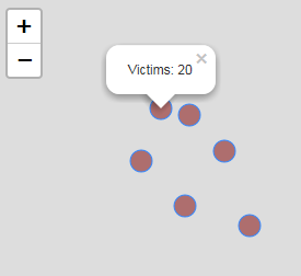
I'm fairly new to JavaScript and I'm currently trying to connect each of my Leaflet markers to a certain portion of text in another div so that when a user clicks the marker, the site will auto scroll to that relevant point in the text.
This is the code I intend to use once each of the markers have their unique ids to be manipulated:
document.getElementById("A").addEventListener("click", function() {
  window.location.href = "#B";
});
So in this case, "A" would be the unique id given to one of the markers, and #B is the id of the text I want to scroll to.
*Edit
I should clarify that the primary issue is actually giving ID's to the markers from the geoJson elements I added onto the map. The relevant code for this is here:
//convert points to circles in layer
function pointToLayer(feature, latlng, attributes){

    var attribute = attributes[0];

    // styling for the circles which are pink with white borders
    var geojsonMarkerOptions = {
        fillColor: "#800000",
        color: "white",
        weight: 1,
        opacity: 1,
        fillOpacity: 0.5,
    };

    var layer = L.circleMarker(latlng, geojsonMarkerOptions);

    //returns layer with circle markers
    return layer;

//function to fill the global attribute array variable at top of page
function processData(data){

    //variable to store the first feature in the data
    var properties = data.features[0].properties;

    //for loop to push each attribute name into array
    for (var attribute in properties){

        //indexOf will only allow attributes with population values to be pushed
        if (attribute.indexOf("Victims") > -1){
            attributes.push(attribute);

        };
    };

    return attributes; //returns attributes array to be used in callback
};


//function to retrieve the data from geojson
function getData(map){

    //load the data and calls functions
    $.getJSON("data/WarCrimes3.geojson");

};
Edit with Whole Code
var map;
var featureId =0;
var attributes = [];

function createMap(){
    // create map and set parameters

    map = L.map('mapid', {
      center: [20.20, 136.25],
      zoom: 2,
      minZoom: 4,
      maxZoom: 8,
      maxBounds: [(25.2, 115.7), (45.7, 155.54)],
    });

    getData(map);

};

function createSymbols(data, attributes){

    L.geoJson(data, {

        pointToLayer: function(feature, latlng){

            return pointToLayer(feature, latlng, attributes);
        }

    }).addTo(map);
};

function pointToLayer(feature, latlng, attributes){

    var attribute = attributes[0];

    var geojsonMarkerOptions = {
        fillColor: "#800000",
        color: "white",
        weight: 1,
        opacity: 1,
        fillOpacity: 0.5,
    };

    var layer = L.circleMarker(latlng, geojsonMarkerOptions);

    layer.featureId = featureId++;

    console.log(layer.featureId)

    return layer;

};

function processData(data){

    //variable to store the first feature in the data
    var properties = data.features[0].properties;

    //for loop to push each attribute name into array
    for (var attribute in properties){

        if (attribute.indexOf("Victims") > -1){
            attributes.push(attribute);

        };
    };

    return attributes; //returns attributes array to be used in callback
};


//function to retrieve the data from geojson
function getData(map){

    $.getJSON("data/sample.geojson", function(response){

      createSymbols(response,attributes);

    });
};

$(document).ready(createMap);
The id's are being logged, but not being assigned to the individual markers

