3

I am trying to import a DWG file (from Autodesk AutoCAD 2019) into QGIS using the Import tool (Project>Import/Export>Import files from DWG/DXF).

I have been following the steps as detailed in the QGIS user manual Ch 13.1.3.4 (https://docs.qgis.org/3.16/en/docs/user_manual/managing_data_source/opening_data.html?highlight=dwg#importing-a-dxf-or-dwg-file).

I create a geopackage file target package, specify the project CRS (epsg:3857) and select the DWG file. However when I select import I get a red error message that says the following: Drawing import failed (). Another time I tried to import it using British National Grid CRS and the error message read: Drawing import failed (unsupported version).

I have also tried selecting an existing geopackage as the target package but this results in a second error message appearing in addition to the first which reads: Could not open layer list ().

Does anyone know how to fix this? Is it because it is a newer version of AutoCAD that created the DWG or?

Drawing import failed error message Could not open layer list error message

2
  • 1
    Save your AutoCAD to a lower version (example 2013).
    – Mapperz
    Commented Jan 14, 2021 at 16:23
  • Just as an FYI, this tool doesn't work when you path it it an existing Geopackage. The target needs to be a bran new geopackage file that you specify the name of, inside of the GUI being used here.
    – nr_aus
    Commented Mar 3, 2022 at 5:29

2 Answers 2

2

AutoCAD DWG file format is a proprietary file format of AutoDesk. therefor compatibility for the file format in most of the none AutoDesk applications are limited and buggy.

Do either of these,

  1. if you really need to use the DWG format try to save the DWG file in older version such as 2004 or 2000 and try it. (DWG is a proprietary binary file format used for storing two- and three- dimensional design data and metadata) But I am Skeptical
  2. the best option is the Autodesk Drawing Exchange File (DXF) format which have native support in QGIS and most of the none AutoDesk application. and better not to use the latest file formats here as well. (AutoCAD DXF is a CAD data file format developed by Autodesk for enabling data interoperability between AutoCAD and other programs)

if you are having problems with converting the file formats, better to install Autodesk AutoCAD TrueView latest version to convert file formats under AutoCAD name.

0

I assume your problem has been solved ages ago.

However, I just found a solution that might be helpful for anyone who searched this post.

1st) Export dwg file into dxf file

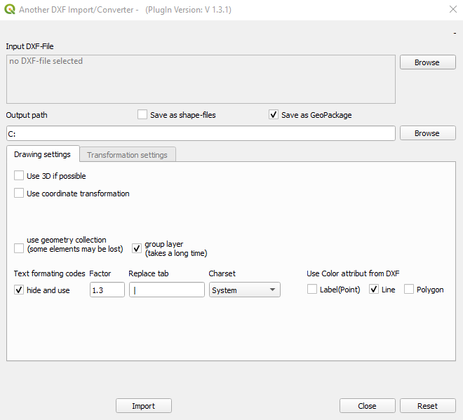
2nd) Use vector>DXF Import/Convert>Import or Convert enter image description here

3rd) define the file to be imported and path for storage enter image description here

4th) Choose save as shape-files or GeoPackage (suggested option as you can export single shape file later without mess you folder will a bunch of layers)

5th) Click "Import" button

6th) Don worry about coordinate transformation as you can always adjust it through Layer CRS property later

Your Answer

By clicking “Post Your Answer”, you agree to our terms of service and acknowledge you have read our privacy policy.

Not the answer you're looking for? Browse other questions tagged or ask your own question.