2

Is there a way to convert the pdf to shapefile in QGIS?

I have plenty of PDF files (I think they are exported from AutoCAD) and I need to georeference them and convert them to shapefile. It would be easier if I do it automatically (Not digitize everything by hand at least), since we have plenty of files.

5
  • 1
    Conversion depends on the content of your PDF files.
    – Erik
    Commented Mar 18, 2021 at 7:59
  • 3
    @BERA Yes I did drag and drop in qgis, also convert it from gdal to raster, but it is not georeferenced
    – Hermetik
    Commented Mar 18, 2021 at 10:53
  • @Erik The content of the PDF file is buldings, pipelines, the logo and etc...
    – Hermetik
    Commented Mar 18, 2021 at 10:54
  • 3
    If the PDFs are indeed exported from CAD, easiest way would be to ask the provider for the DWG/DXF files.
    – Erik
    Commented Mar 18, 2021 at 11:30
  • You might search on pdf to shapefile or variations thereon. There is software that claims they can do it. I assume that if your features are not stored as vectors in your pdfs but as parts of a raster, you will not be able to use these converters. In that case you could try the GDAL-Raster Conversion-Polygonize(raster to vector) tool but the success of that hinges in part on having shared pixel values for each different set features and distinct ones between features..
    – John
    Commented Mar 22, 2021 at 13:52

1 Answer 1

1

I don't know how the PDF was created and how complicated are the features there (as someone already said, you could ask provider for the original format - DWG, etc.), but if it is only general image (can be PDF, JPG,..) with few line features, you can add it to QGIS and then georeference it using tool Georeferencer (find it in Tab Raster --> Georeferencer).

You can use for example Google basemap and indentify (by clicking at the specific point in PDF you've imported into Georeferencer and then using option From Map Canvas) at least four points at corners. Then go to Georeferencer Settings, use method, click Run and the PDF will be exactly at the place you want it.

Unfortunately then you have to create new layer and re-draw features from PDF manually. It in not the fastest and funniest solution, but I think that's the only thing you can do with PDG or JPG.
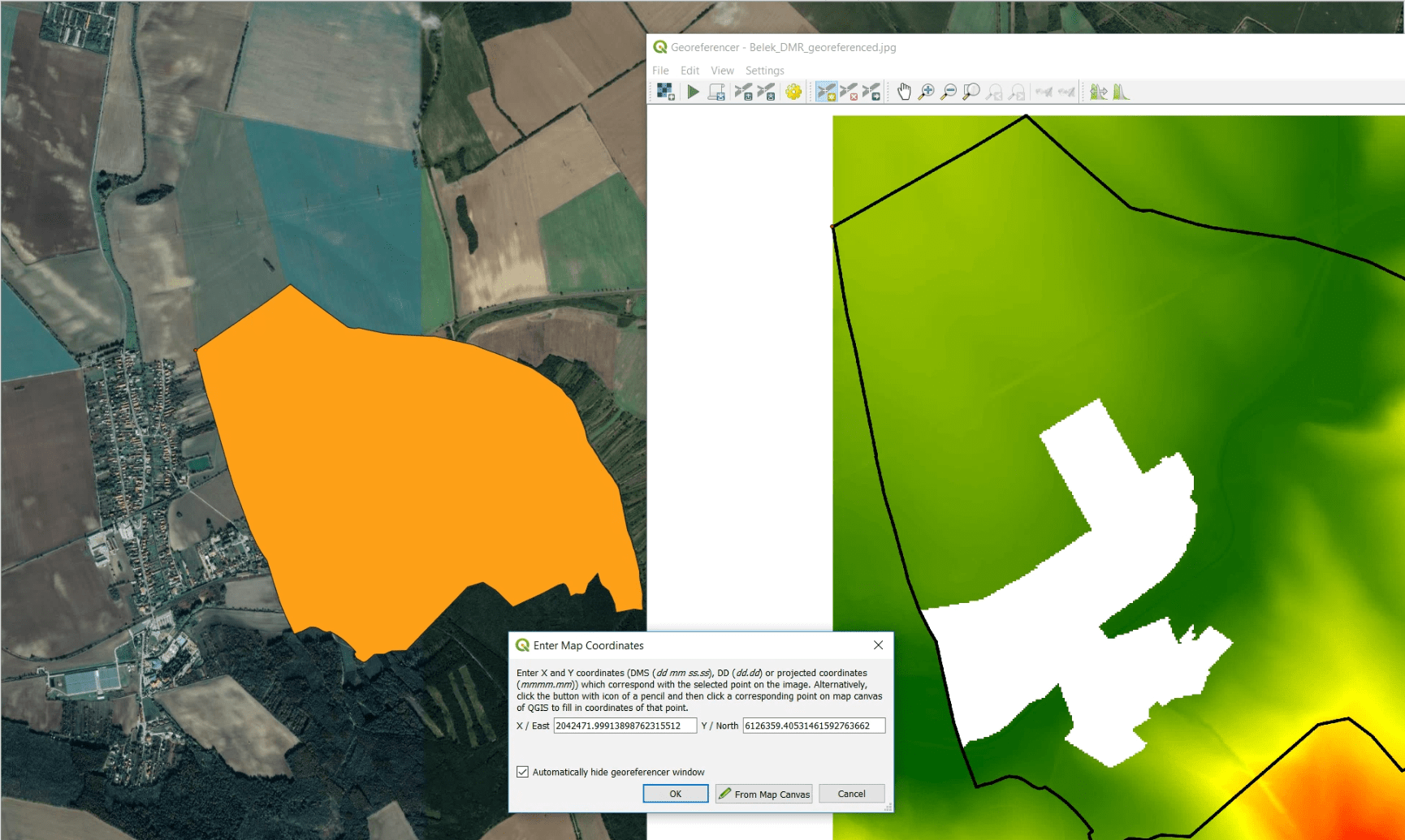
enter image description here

1
  • From the question it should be assumed that those are vector files, so assuming raster images is most probably out of scope Commented Jun 16, 2023 at 9:38

Your Answer

By clicking “Post Your Answer”, you agree to our terms of service and acknowledge you have read our privacy policy.

Not the answer you're looking for? Browse other questions tagged or ask your own question.