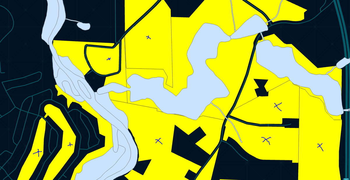
I am working with 2 Polygon Shapefiles: parcels & wetlands
Essentially what I want to accomplish is to filter the parcels dataset, where I only keep parcels that contain less than 50% Wetlands. For example the yellow parcels marked blue would be kept while the others would be filtered out, as the wetlands layer covers too much of the parcel
I've researched and tried various Spatial Joins, but none offer an option for %'s, and the gpd.overlay option only works on a DataFrame Level, not on individual polygons.
I was thinking some sort of comparison of Shape Areas, where:
filtered_parcels = filtered_parcels[(wetlands['shape_area'] <= parcels['shape_area'] * 0.5)]
However, I don't know how to obtain the Shape Area of the Wetlands contained only within a certain parcel.

