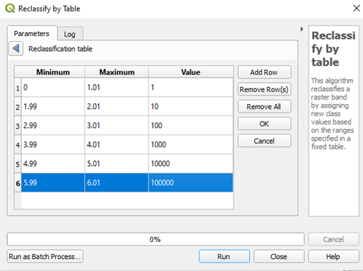
I am trying to find the difference between land cover data from two years. I have used the same classification for both the raster files. For eg:
1-Agriculture
2-Forest
3-Urban
4-Water bodies
5-Barren lands
6-Bare areas
If I want to calculate the change using the raster calculator in QGIS, do I need to reclassify either of the rasters to different values? And what should be the order of rasters in raster-calculator? Will the interpretation of results stay the same with different orders? For eg: If I have data from years 2019 and 2020, then should it be 2020-2019 or 2019-2020?
Also, help me understand how to interpret the results. I found a similar question on this forum, Change Detection using Raster Calculator, but it is still not very clear to me.

