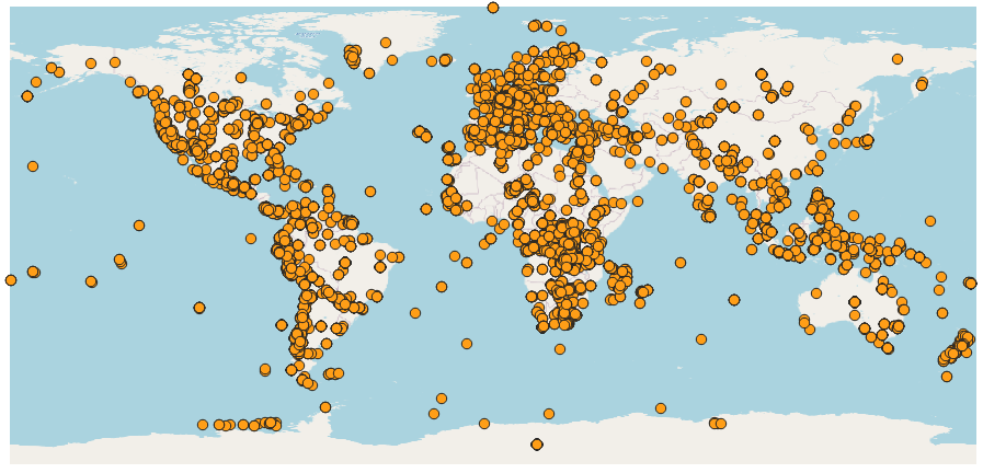
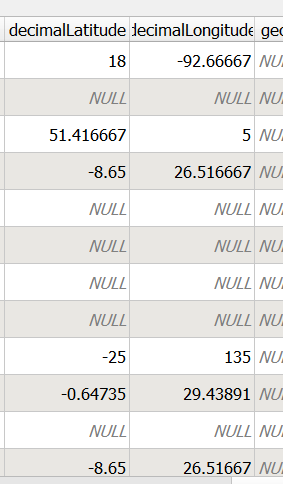
I've a problem importing XML data on QGIS, I tried with the plugin LandXML but I read in some others answer here that probably it doesn't work because it is not landXML.
Do you know what I could do?
Here the body of the XML file:
<?xml version="1.0" encoding="UTF-8"?>
<eml:eml xmlns:eml="eml://ecoinformatics.org/eml-2.1.1"
xmlns:xsi="http://www.w3.org/2001/XMLSchema-instance"
xsi:schemaLocation="eml://ecoinformatics.org/eml-2.1.1 http://rs.gbif.org/schema/eml-gbif-profile/1.1/eml.xsd"
packageId="0c4bf92b-95c9-4a2a-9756-67d98195459f" system="http://gbif.org" scope="system"
xml:lang="en">
<dataset>
<alternateIdentifier>10.15468/4gzrjh</alternateIdentifier>
<alternateIdentifier>http://ipt.naturalsciences.be/ipt/resource?r=be_rbins_vertebrates_aves</alternateIdentifier>
<title>Royal Belgian Institute of Natural Sciences Bird collection</title>
<creator>
<individualName>
<givenName>Olivier</givenName>
<surName>Pauwels</surName>
</individualName>
<organizationName>Royal Belgian Institute for Natural Sciences - Department of Scientific Heritage Service</organizationName>
<positionName>curator</positionName>
<address>
<deliveryPoint>Vautierstraat 29</deliveryPoint>
<city>Brussels</city>
<postalCode>1000</postalCode>
<country>BELGIUM</country>
</address>
</creator>
<metadataProvider>
<individualName>
<givenName>Thomas</givenName>
<surName>Vandenberghe</surName>
</individualName>
<organizationName>Royal Belgian Institute for Natural Sciences</organizationName>
<positionName>Data manager</positionName>
<address>
<deliveryPoint>Vautierstraat 29</deliveryPoint>
<city>Brussels</city>
<postalCode>1000</postalCode>
<country>BELGIUM</country>
</address>
<electronicMailAddress>[email protected]</electronicMailAddress>
<userId directory="http://orcid.org/">0000-0002-9269-6548</userId>
</metadataProvider>
<associatedParty>
<individualName>
<givenName>Patrick</givenName>
<surName>Semal</surName>
</individualName>
<organizationName>Royal Belgian Institute for Natural Sciences</organizationName>
<positionName>Head of Section Scientific Heritage</positionName>
<address>
<deliveryPoint>Vautierstraat 29</deliveryPoint>
<city>Brussels</city>
<postalCode>1000</postalCode>
<country>BELGIUM</country>
</address>
<electronicMailAddress>[email protected]</electronicMailAddress>
<userId directory="http://orcid.org/">0000-0002-4048-7728</userId>
<role>CONTENT_PROVIDER</role>
</associatedParty>
<pubDate> 2021-01-25 </pubDate>
<language>ENGLISH</language>
<abstract>
<para>The bird collection of the Royal Belgian Institute of Natural Sciences is made up
of around 82.000 specimens. It includes a significant collection of skeletons and
eggs as well as type material for 92 species. It is one of the Institute's
oldest collections and for much of the historical material, including the tropical
birds, the Institute owes thanks to ornithologist Bernard du Bus de Gisignies, the
first director of the Museum of Natural Sciences in 1848. Alphonse Dubois, who was
appointed curator of the vertebrate collections in 1869, was the first to describe
many of De Gisignies’ specimens. In the 1930s Zoologist René Verheyen added a great
deal of material to the ornithological collections and in particular, an
exceptionally large collection of Belgian and Central African fauna. The Royal
Belgian Institute of Natural Sciences Bird Collection contains 100061 digitised
specimens of 10477 taxa. The following classes are included: Actinopterygii,
Amphibia Linnaeus, 1758, Aves, Mammalia Linnaeus, 1758, Reptilia Laurenti,
1768</para>
</abstract>
<keywordSet>
<keyword>DaRWIN</keyword>
<keyword>RBINS</keyword>
<keyword>Aves</keyword>
<keyword>natural history collection</keyword>
<keywordThesaurus>N/A</keywordThesaurus>
</keywordSet>
<keywordSet>
<keyword>Occurrence</keyword>
<keywordThesaurus>GBIF Dataset Type Vocabulary: http://rs.gbif.org/vocabulary/gbif/dataset_type.xml</keywordThesaurus>
</keywordSet>
<keywordSet>
<keyword>Specimen</keyword>
<keywordThesaurus>GBIF Dataset Subtype Vocabulary: http://rs.gbif.org/vocabulary/gbif/dataset_subtype.xml</keywordThesaurus>
</keywordSet>
<intellectualRights>
<para> This work is licensed under a <ulink
url="http://creativecommons.org/licenses/by-nc/4.0/legalcode">
<citetitle>Creative Commons Attribution Non Commercial (CC-BY-NC) 4.0 License</citetitle>
</ulink> . </para>
</intellectualRights>
<coverage>
<geographicCoverage>
<geographicDescription>Afghanistan, Albania, Algeria, Angola, Antigua and Barbuda, Argentina, Armenia, Aruba, Australia, Austria, Azerbaijan, Bahamas, Belgium, Bolivia, Bosnia and Herzegovina, Botswana, Brazil, Bulgaria, Burundi, Cambodia, Cameroon, Canada, Central African Republic, Chad, Chile, China, Colombia, Comoros, Congo, Costa Rica, Croatia, Cuba, Cyprus, Czechia, Denmark, Dominican Republic, DR Congo, Ecuador, Egypt, El Salvador, Estonia, Ethiopia, Falkland Islands (Malvinas), Faroe Islands, Fiji, Finland, France, French Guiana, French Polynesia, Gabon, Georgia, Germany, Ghana, Greece, Greenland, Guadeloupe, Guatemala, Guinea, Guyana, Honduras, Hungary, Iceland, India, Indonesia, Iran, Iraq, Ireland, Israel, Italy, Jamaica, Japan, Jordan, Kazakhstan, Kenya, Kyrgyzstan, Laos, Lebanon, Libya, Luxembourg, Macedonia, Madagascar, Malawi, Malaysia, Malta, Marshall Islands, Martinique, Mauritania, Mexico, Micronesia, Micronesia, Federated States of, Montenegro, Morocco, Mozambique, Myanmar, Namibia, Nepal, Netherlands, New Caledonia, New Zealand, Nicaragua, Niger, Nigeria, North Korea, Norway, Pakistan, Palestinian Territory, Panama, Papua New Guinea, Paraguay, Peru, Philippines, Poland, Portugal, Réunion, Romania, Russia, Rwanda, Saint Helena, Samoa, Saudi Arabia, Scandinavia, Senegal, Serbia, Singapore, Slovakia, Solomon Islands, South Africa, South Georgia and South Sandwich Islands, South Sudan, Spain, Sri Lanka, St Vincent and Grenadines, Sudan, Suriname, Svalbard and Jan Mayen Islands, Sweden, Switzerland, Syria, Tanzania, Thailand, Togo, Trinidad and Tobago, Tunisia, Turkey, Turkmenistan, Uganda, Ukraine, United Kingdom, United States, Uruguay, Uzbekistan, Venezuela, Vietnam, Yemen, Zambia, Zimbabwe</geographicDescription>
<boundingCoordinates>
<westBoundingCoordinate>-179.967</westBoundingCoordinate>
<eastBoundingCoordinate>178.24</eastBoundingCoordinate>
<northBoundingCoordinate>85</northBoundingCoordinate>
<southBoundingCoordinate>-78.159</southBoundingCoordinate>
</boundingCoordinates>
</geographicCoverage>
<temporalCoverage>
<rangeOfDates>
<beginDate>
<calendarDate> 1814-09-01 </calendarDate>
</beginDate>
<endDate>
<calendarDate> 2019-01-09 </calendarDate>
</endDate>
</rangeOfDates>
</temporalCoverage>
<taxonomicCoverage>
<taxonomicClassification>
<taxonRankName>Class</taxonRankName>
<taxonRankValue>Actinopterygii, Amphibia Linnaeus, 1758, Aves, Mammalia Linnaeus, 1758, Reptilia Laurenti, 1768</taxonRankValue>
</taxonomicClassification>
</taxonomicCoverage>
</coverage>
<maintenance>
<description>
<para/>
</description>
<maintenanceUpdateFrequency>continually</maintenanceUpdateFrequency>
</maintenance>
<contact>
<organizationName>Biodiversity and Ecological Data and Information Centre - Royal Belgian Institute for Natural Sciences</organizationName>
<address>
<deliveryPoint>Vautierstraat 29</deliveryPoint>
<city>Brussels</city>
<postalCode>1000</postalCode>
<country>BELGIUM</country>
</address>
<electronicMailAddress>[email protected]</electronicMailAddress>
</contact>
</dataset>
<additionalMetadata>
<metadata>
<gbif>
<dateStamp>2022-03-17T18:28:19Z</dateStamp>
<citation>Pauwels O, Vandenberghe T (2021). Royal Belgian Institute of Natural Sciences Bird collection. Royal Belgian Institute of Natural Sciences. Occurrence dataset https://doi.org/10.15468/4gzrjh accessed via GBIF.org on 2022-03-17.</citation>
</gbif>
</metadata>
</additionalMetadata>
</eml:eml>


