0

How can I add data from the USGS National Map server to ArcMap?

Specific goal is to load data and processed products like 3DEP hillshades from the TNM Download without having to download it locally, make a hillshade, etc.

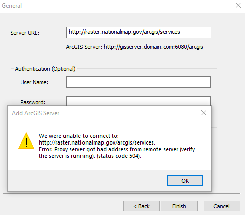
I think I need the raster.nationalmap.gov service (http://raster.nationalmap.gov/arcgis/services), but I keep getting connection error after a long delay.

I am following the USGS instructions here although I am not certain if this is what I need for 3DEP hillshades.

enter image description here

Using ArcMap 10.7 on Windows 10

1 Answer 1

1

I found a similar question in the ESRI forums here. The answer by "isburns" on 7/12/2021 is exactly what I needed. Here's a summary:

The USGS has a video tutorial for adding the 3DEP service to ArcMap. Key point is to use "Add ArcGIS Server" and this URL: https://elevation.nationalmap.gov/arcgis/services/3DEPElevation/ImageServer/WCSServer

The video also shows how to access the processed products (right click on 3DEPElevation layer after you add it to your map; click Properties; then Processing Templates tab).

1
  • Any documentation or video on using web services from 2015 is suspect in terms of service URLs. Although caveat utilitor should apply given the age of the video, shame on USGS for leaving training cruft out on the web to confuse users.
    – bixb0012
    Commented Apr 16, 2022 at 23:38

Your Answer

By clicking “Post Your Answer”, you agree to our terms of service and acknowledge you have read our privacy policy.

Not the answer you're looking for? Browse other questions tagged or ask your own question.