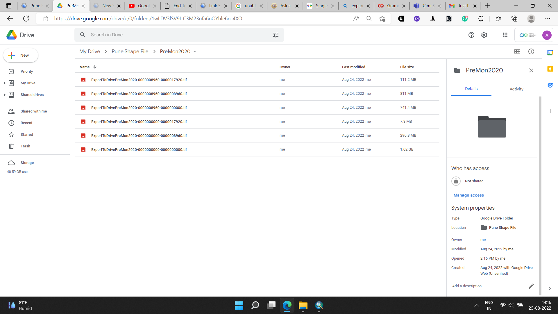
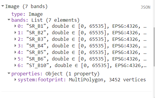
I am unable to identify the bands after exporting as it shows no band name after exporting in google drive
I have tried to download Landsat 8 Surface Reflectance Tier 1 image. I filtered the images based on cloud cover, boundary shape file and satellite date. I also clipped the file. I further filtered to obtain only 7 bands .
How can we control the band names when exporting to google earth engine?
// Variable to import Landsat Satellite Files
var image=ee.ImageCollection("LANDSAT/LC08/C02/T1_L2")

// Filter the number of images available for shape file region
var filter_region=image.filterBounds(roi)

// Filter the region with less than 1 % cloud cover and reduced bands
var filter_cloud=filter_region.filterMetadata('CLOUD_COVER','less_than',3).select(['SR_B1','SR_B2','SR_B3','SR_B4','SR_B5','SR_B6','ST_B10']);

//Clip the Pune bands

var rgbVis={min:0,max:3000,bands:['SR_B4','SR_B3','SR_B2']};

var PNClip_PreMon2014=filter_cloud.filterDate('2014-03-01','2014-04-30').mean().clip(roi);
print(PNClip_PreMon2014);
Map.addLayer(PNClip_PreMon2014,rgbVis,'Pre Monsoon 2014 Clipped Image ');
var PNClip_PreMon2017=filter_cloud.filterDate('2017-03-01','2017-03-31').mean().clip(roi);
print(PNClip_PreMon2017);
Map.addLayer(PNClip_PreMon2017,rgbVis,'Pre Monsoon 2017 Clipped Image ');
var PNClip_PreMon2020=filter_cloud.filterDate('2020-03-01','2020-03-31').mean().clip(roi);
print(PNClip_PreMon2020);
Map.addLayer(PNClip_PreMon2020,rgbVis,'Pre Monsoon 2020 Clipped Image ');
var PNClip_PostMon2014=filter_cloud.filterDate('2014-10-01','2014-10-30').mean().clip(roi);
print(PNClip_PostMon2014);
Map.addLayer(PNClip_PostMon2014,rgbVis,'Post Monsoon 2014 Clipped Image ');
var PNClip_PostMon2017=filter_cloud.filterDate('2017-11-01','2017-11-30').mean().clip(roi);
print(PNClip_PostMon2017);
Map.addLayer(PNClip_PostMon2017,rgbVis,'Post Monsoon 2017 Clipped Image ');
var PNClip_PostMon2020=filter_cloud.filterDate('2020-11-01','2020-12-30').mean().clip(roi);
print(PNClip_PostMon2020);
Map.addLayer(PNClip_PostMon2020,rgbVis,'Post Monsoon 2020 Clipped Image ');

// Check the project for Shape File and Clipped Pune Files

var projection1 = PNClip_PostMon2020.projection().getInfo();
print(projection1)
var projection2 = roi.projection().getInfo();
print(projection2)

// Export the Clipped Images

Export.image.toDrive({image:PNClip_PreMon2014,description:'ExportToDrivePreMon2014',fileFormat:'GeoTIFF',scale:10,region:roi,maxPixels:1E10});
Export.image.toDrive({image:PNClip_PreMon2017,description:'ExportToDrivePreMon2017',fileFormat:'GeoTIFF',scale:10,region:roi,maxPixels:1E10});
Export.image.toDrive({image:PNClip_PreMon2020,description:'ExportToDrivePreMon2020',fileFormat:'GeoTIFF',scale:10,region:roi,maxPixels:1E10});
Export.image.toDrive({image:PNClip_PostMon2014,description:'ExportToDrivePostMon2014',fileFormat:'GeoTIFF',scale:10,region:roi,maxPixels:1E10});
Export.image.toDrive({image:PNClip_PostMon2017,description:'ExportToDrivePostMon2017',fileFormat:'GeoTIFF',scale:10,region:roi,maxPixels:1E10});
Export.image.toDrive({image:PNClip_PostMon2020,description:'ExportToDrivePostMon2020',fileFormat:'GeoTIFF',scale:10,region:roi,maxPixels:1E10});


