I'm trying to create a spatial view which meets the following criteria:
Sentinel hotspots registered within 2km of powerline (feeder)
AND
QRFS point located within 4km radius of sentinel hotspots
AND
Fire danger index rating Moderate or above.
I have been somewhat successful creating the query which is creating the buffers that I want. However, I need to modify the spatial join because it is duplicating the buffer for every line that it intersects. I simply want one buffer.
This is my code:
SELECT  row_number() OVER () AS gid,
    sub_qry.geom
   FROM (   SELECT (st_dump(st_union(st_buffer(sentinel.geom, 2000::double precision)::geometry))).geom::geography AS geom
                FROM dea_hotspot_centroid sentinel
                JOIN bom_fire_danger_ratings ratings ON st_intersects(ratings.geom, sentinel.geom)
                JOIN gis.qrfs_permitted_burn qrfs  ON st_dwithin(qrfs.geom, sentinel.geom, 4000)
                WHERE
                    ratings.day = 1::double precision
                    AND NOT (sentinel.power >=50 AND sentinel.confidence >=80)
                    AND (ratings.fire_risk in ('Moderate', 'Extreme','Severe','Catastrophic'))
         ) sub_qry
     JOIN feeders f ON st_intersects(sub_qry.geom, ST_Union(f.geom))
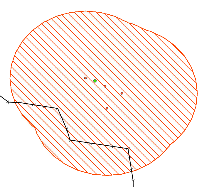
In the below image, the buffer is created around the hotspots (orange circles). There are 13 powerlines which intersect the buffer.
How can I modify the code to only create one polygon instead of duplicating it for each powerline which it intersects?

