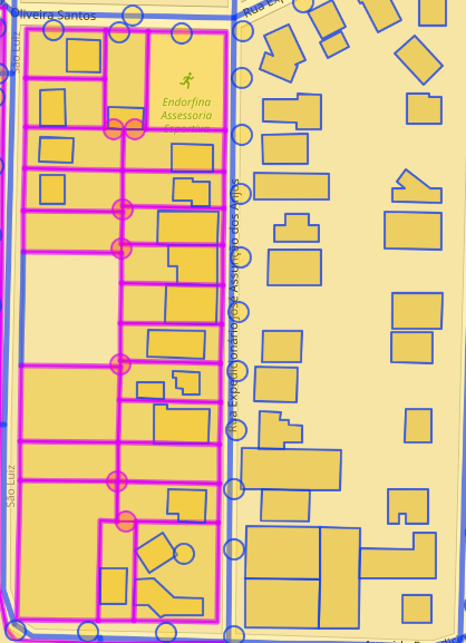
Try this query to filter only buildings and output a geojson.
[out:json];

area[name="Ouro Preto"]->.b;
rel(area.b)[name="Ouro Preto"];
map_to_area -> .a;


way["building"](area.a);
out geom;

relation["building"](area.a);out;
way(r)[!"building:part"];
convert item ::=::,::geom=geom(),_osm_type=type();
out geom;
run the query from
https://overpass-turbo.eu/s/1Hab
sample output:
{
  "version": 0.6,
  "generator": "Overpass API 0.7.61.5 4133829e",
  "osm3s": {
    "timestamp_osm_base": "2024-02-09T22:14:53Z",
    "timestamp_areas_base": "2024-02-09T18:24:03Z",
    "copyright": "The data included in this document is from www.openstreetmap.org. The data is made available under ODbL."
  },
  "elements": [

{
  "type": "way",
  "id": 8609215,
  "bounds": {
    "minlat": -19.8758738,
    "minlon": -43.9790817,
    "maxlat": -19.8738722,
    "maxlon": -43.9771127
  },
  "nodes": [
    351982128,
    61264141,
    61264318,
    61264301,
    61264287,
    61264270,
    61264251,
    61264235,
    61264217,
    61264202,
    61264184,
    61264171,
    61264154,
    351982127,
    351982129,
    6832228139,
    351982135,
    351982143,
    351982142,
    6383366111,
    6832228138,
    351982130,
    351982128
  ],
  "geometry": [
    { "lat": -19.8748955, "lon": -43.9773098 },
    { "lat": -19.8756889, "lon": -43.9771127 },
    { "lat": -19.8758738, "lon": -43.9779543 },
    { "lat": -19.8751530, "lon": -43.9781335 },
    { "lat": -19.8752195, "lon": -43.9784360 },
    { "lat": -19.8751560, "lon": -43.9784518 },
    { "lat": -19.8752450, "lon": -43.9788567 },
    { "lat": -19.8749198, "lon": -43.9789375 },
    { "lat": -19.8748302, "lon": -43.9785302 },
    { "lat": -19.8744404, "lon": -43.9786270 },
    { "lat": -19.8745230, "lon": -43.9790029 },
    { "lat": -19.8742060, "lon": -43.9790817 },
    { "lat": -19.8738722, "lon": -43.9775629 },
    { "lat": -19.8744116, "lon": -43.9774289 },
    { "lat": -19.8745176, "lon": -43.9773380 },
    { "lat": -19.8744760, "lon": -43.9772549 },
    { "lat": -19.8744502, "lon": -43.9771992 },
    { "lat": -19.8745940, "lon": -43.9771489 },
    { "lat": -19.8746999, "lon": -43.9771456 },
    { "lat": -19.8746981, "lon": -43.9771899 },
    { "lat": -19.8746942, "lon": -43.9772871 },
    { "lat": -19.8747283, "lon": -43.9772917 },
    { "lat": -19.8748955, "lon": -43.9773098 }
  ],
  "tags": {
    "building": "supermarket"
  }
},
{
  "type": "way",
  "id": 31489703,
  "bounds": {
    "minlat": -19.8714245,
    "minlon": -43.9798083,
    "maxlat": -19.8711520,
    "maxlon": -43.9795213
  },
  "nodes": [
    351982912,
    351982913,
    351982914,
    351982915,
    351982918,
    351982919,
    351982921,
    351982912
  ],
  "geometry": [
    { "lat": -19.8711520, "lon": -43.9795750 },
    { "lat": -19.8713892, "lon": -43.9795213 },
    { "lat": -19.8714245, "lon": -43.9795562 },
    { "lat": -19.8714119, "lon": -43.9797681 },
    { "lat": -19.8712807, "lon": -43.9798083 },
    { "lat": -19.8712555, "lon": -43.9797118 },
    { "lat": -19.8711823, "lon": -43.9797198 },
    { "lat": -19.8711520, "lon": -43.9795750 }
  ],
  "tags": {
    "building": "yes",
    "created_by": "Merkaartor 0.13"
  }
},
{
  "type": "way",
  "id": 31489709,
  "bounds": {
    "minlat": -19.8710713,
    "minlon": -43.9819487,
    "maxlat": -19.8708947,
    "maxlon": -43.9816778
  },
  "nodes": [
    351982929,
    351982931,
    351982934,
    351982942,
    351982929
  ],
  "geometry": [
    { "lat": -19.8709452, "lon": -43.9819487 },
    { "lat": -19.8710033, "lon": -43.9819380 },
    { "lat": -19.8710713, "lon": -43.9816778 },
    { "lat": -19.8708947, "lon": -43.9817154 },
    { "lat": -19.8709452, "lon": -43.9819487 }
  ],
  "tags": {
    "addr:city": "Belo Horizonte - MG",
    "addr:housename": "Padaria Trigo Dourado",
    "addr:housenumber": "540",
    "addr:postcode": "31310-240",
    "addr:street": "Rua Conceição do Mato Dentro",
    "addr:suburb": "Ouro Preto",
    "building": "yes",
    "building:levels": "2",
    "name": "Padaria Trigo Dourado",
    "shop": "bakery"
  }
},
{
  "type": "way",
  "id": 48414351,
  "bounds": {
    "minlat": -19.8653669,
    "minlon": -43.9837218,
    "maxlat": -19.8651555,
    "maxlon": -43.9835352
  },
  "nodes": [
    614918567,
    614918572,
    614918581,
    614918602,
    614918612,
    614918613,
    614918567
  ],
  "geometry": [
    { "lat": -19.8651555, "lon": -43.9836955 },
    { "lat": -19.8652798, "lon": -43.9837218 },
    { "lat": -19.8653669, "lon": -43.9835903 },
    { "lat": -19.8652824, "lon": -43.9835352 },
    { "lat": -19.8652078, "lon": -43.9836456 },
    { "lat": -19.8651654, "lon": -43.9836613 },
    { "lat": -19.8651555, "lon": -43.9836955 }
  ],
  "tags": {
    "building": "yes"
  }
},
{
  "type": "way",
  "id": 95953282,
  "bounds": {
    "minlat": -19.8706899,
    "minlon": -43.9822847,
    "maxlat": -19.8704980,
    "maxlon": -43.9820407
  },
  "nodes": [
    3322143376,
    1111816144,
    1111816153,
    1111816154,
    3322143376
  ],
  "geometry": [
    { "lat": -19.8705413, "lon": -43.9822847 },
    { "lat": -19.8706899, "lon": -43.9821647 },
    { "lat": -19.8706638, "lon": -43.9820407 },
    { "lat": -19.8704980, "lon": -43.9820828 },
    { "lat": -19.8705413, "lon": -43.9822847 }
  ],
  "tags": {
    "amenity": "bank",
    "brand": "Santander",
    "brand:wikidata": "Q5835668",
    "brand:wikipedia": "en:Santander Bank",
    "building": "yes",
    "name": "Santander",
    "operator": "Santander",
    "source": "Bing;survey"
  }
},
{
  "type": "way",
  "id": 128328700,
  "bounds": {
    "minlat": -7.9956116,
    "minlon": -34.8597882,
    "maxlat": -7.9951364,
    "maxlon": -34.8590839
  },
  "nodes": [
    1418503461,
    1418503494,
    1418503498,
    1418503475,
    1418503453,
    1418503442,
    6139756591,
    6139756592,
    6139756590,
    6139756589,
    6139756588,
    6139756587,
    6139756586,
    6139756585,
    1418503485,
    1418503444,
    1418503461
  ],
  "geometry": [
    { "lat": -7.9954107, "lon": -34.8592364 },
    { "lat": -7.9954121, "lon": -34.8591833 },
    { "lat": -7.9951364, "lon": -34.8591532 },
    { "lat": -7.9951397, "lon": -34.8590839 },
    { "lat": -7.9954373, "lon": -34.8590949 },
    { "lat": -7.9955110, "lon": -34.8591406 },
    { "lat": -7.9954858, "lon": -34.8595478 },
    { "lat": -7.9955345, "lon": -34.8595496 },
    { "lat": -7.9955385, "lon": -34.8594912 },
    { "lat": -7.9956116, "lon": -34.8595040 },
    { "lat": -7.9956089, "lon": -34.8595783 },
    { "lat": -7.9955431, "lon": -34.8595644 },
    { "lat": -7.9955362, "lon": -34.8596707 },
    { "lat": -7.9954823, "lon": -34.8596597 },
    { "lat": -7.9954591, "lon": -34.8597882 },
    { "lat": -7.9953623, "lon": -34.8597804 },
    { "lat": -7.9954107, "lon": -34.8592364 }
  ],
  "tags": {
    "building": "yes",
    "name": "Antiga sede da TV Globo Nordeste"
  }
},
{
  "type": "way",
  "id": 128351221,
  "bounds": {
    "minlat": -7.9836090,
    "minlon": -34.8569200,
    "maxlat": -7.9817932,
    "maxlon": -34.8557339
  },
  "nodes": [
    1418697907,
    5830962193,
    6871717953,
    6871717951,
    5830962194,
    5830962189,
    5830962190,
    5830962188,
    5830962187,
    5830962191,
    5830962192,
    1418697904,
    1418697910,
    7424105933,
    7424105934,
    7424105935,
    1418697894,
    1418697907
  ],
  "geometry": [
    { "lat": -7.9818608, "lon": -34.8566166 },
    { "lat": -7.9827253, "lon": -34.8562632 },
    { "lat": -7.9827373, "lon": -34.8562932 },
    { "lat": -7.9827671, "lon": -34.8563673 },
    { "lat": -7.9827792, "lon": -34.8563975 },
    { "lat": -7.9819014, "lon": -34.8567564 },
    { "lat": -7.9819671, "lon": -34.8569200 },
    { "lat": -7.9833803, "lon": -34.8563336 },
    { "lat": -7.9833285, "lon": -34.8561841 },
    { "lat": -7.9828217, "lon": -34.8563912 },
    { "lat": -7.9827653, "lon": -34.8562504 },
    { "lat": -7.9836090, "lon": -34.8559055 },
    { "lat": -7.9835402, "lon": -34.8557339 },
    { "lat": -7.9829463, "lon": -34.8559767 },
    { "lat": -7.9825149, "lon": -34.8561531 },
    { "lat": -7.9820811, "lon": -34.8563304 },
    { "lat": -7.9817932, "lon": -34.8564481 },
    { "lat": -7.9818608, "lon": -34.8566166 }
  ],
  "tags": {
    "building": "transportation",
    "layer": "1"
  }
},
{
  "type": "way",
  "id": 139818910,
  "bounds": {
    "minlat": -7.9990270,
    "minlon": -34.8696357,
    "maxlat": -7.9987831,
    "maxlon": -34.8693902
  },
  "nodes": [
    1532341701,
    1532341703,
    1532341698,
    1532341695,
    1532341711,
    1532341700,
    1532341710,
    1532341702,
    5782239142,
    5782239143,
    1532341704,
    1532341689,
    1532341707,
    1532341708,
    1532341713,
    1532341714,
    1532341687,
    1532341721,
    1532341688,
    1532341701
  ],

