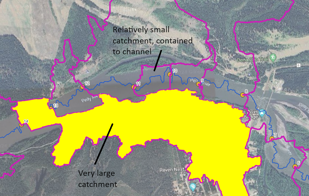
I am looking to delineate catchment areas of roughly equal size at specified outlet points along a channel. I need something that adds preference to capturing the floodplain on either side of the channel in each point (ideally), rather than the current result with wbt_watershed, which has some catchment areas confined to the channel and others with much larger drainage areas (see screenshot).
In exploring existing tools, I can't find any that take in predefined outlet points and add preference in delineation to equal size catchments, so I am looking for recommendations there. I know of the whitebox tools which has the watershed function (current result), and the isobasins tool, though this one does not accept outlet points.
I also know of the plugin for polystrips that is used to define regular polygons along a line, though I am looking for something that creates polygons informed by the drainage accumulation rather than simple geometric bounds. (Generating equal sized polygons along line with PyQGIS)
wbt_watershed (as implemented in R) https://www.whiteboxgeo.com/manual/wbt_book/available_tools/hydrological_analysis.html#Watershed

