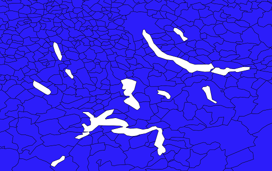
I have a shapefile with multipart geometry (multipolygons), namely communities (blue on the picture below). There are also lakes (white), but for these I don't have a geometry, they're just "empty".
I want to conduct a point-in-polygon analysis with another point dataset. Each point should be assigned to a community or be deleted when it falls outside a community (e.g. in a lake). The problem is that there are many points for lake-bordering communities that are very close to the shore. Because of the strong generalization, these points get accidentally deleted even though they would actually belong to a community.

The only thing I can think about is somehow to extend the shore line of lake-bordering communities by about 100m, but I'm wondering whether there is some way of doing this automatically in QGIS. I have no clue though I would approach this problem.
