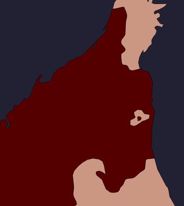
Looking at this map data from naturalearth (part of Oman & UAE to be specific), each country is defined as a multipolygon. In this case UAE (in red) contains two polygons and Oman (beige) three.

Problem is that QGIS claims UAE to be invalid, since the smaller polygon is "inside" the other one. I've tried making the small polygon a ring instead, but that's also not okay, since it does not touch the other ring.
How should this be organized in order to be valid? Must these be separate features? Joined physically?
