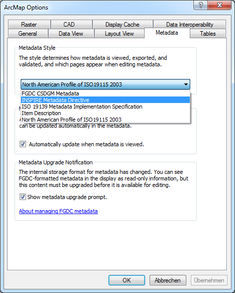
I would like to begin by saying that I have never implemented INSPIRE metadata with my spatial datasets before. I am undertaking a project which requires my geodatabase metadata to be in the standards format specified in Regulation 1205/2008/EC. I believe I have most of the information required, for example 'Resource Title', 'Resource Abstract', 'Topic Category', 'Keyword', 'Geographic Bounding Box', 'Lineage', 'Access and use', Responsible organisation', 'Metadata point of contact', 'Metadata date', 'Metadata language', 'Coordinate reference system'.
My dataset are just vector points. I am using ArcCatalog and ISO 19139 Metadata Implementation Specification. I was wondering where I might put details of 'Conformity' and how should I go about recording 'Encoding' in the metadata. Is ESRI software enough to create metadata which meets INSPIRE standards?

