2

I am evaluating field data collection form-making apps and looking at Snap! or Fulcrum, or something else you know about that I don't!

The key features it needs to have are:

  • Map-based: I need to load on features to visit and send people out, or alternately let them create a feature as part of filling out a form for it.

  • Spatially-based records: a user drops a georeferenced point to start a new record and the lat/long/UTM coordinates are part of the attributes.

  • Required fields: a record should not be allowed to get saved unless required fields have been populated with values.

  • Pick lists: no-brainer here, both apps do it, but easily managed and updated pick lists are a good thing.

  • Offline: users need to be offline and still use the map.

...Ideally not a cloud based thing, I am hoping data collectors can export a file (csv, KML, whatnot) which I can open to consolidate multiple data collection dates into a single spreadhseet. I know both Snap! and Fulcrum depend on cloud syncing, and if I have to go that way so-be-it, but it would be nice to be the owner of my own data.

Any suggestions are welcome, so far my trials on both apps have been so-so. If any apps out there could take a PDF Form import and turn it into the collection fields/layout that would be even better.

1
  • I've edited your question to remove your wording that seeks opinions. I've done this because I think its explicit asking for opinions would risk attracting early close votes with this close reason: "Many good questions generate some degree of opinion based on expert experience, but answers to this question will tend to be almost entirely based on opinions, rather than facts, references, or specific expertise."
    – PolyGeo
    Commented Oct 2, 2014 at 0:32

3 Answers 3

1

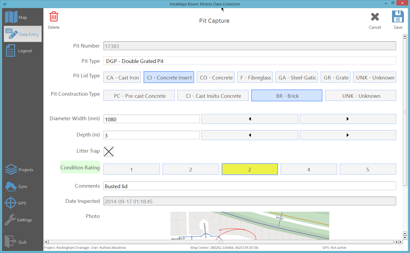
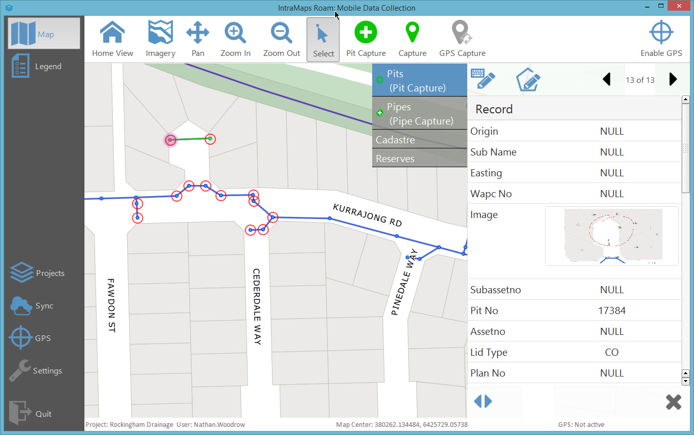
If Windows tablets are an option (yes yes I know) then you could always try my project Roam

http://dms-aus.github.io/Roam/

enter image description here enter image description here

It is standlone Python app and based on QGIS 2.4. You can use what ever data you like. Shapefile, KML (read only of course on that), Sqlite, etc. Supports any format QGIS does read and write.

Supports auto generated forms and custom forms using Qt Creator. Photos, etc.

1
  • Doh, just noticed the ios tag. Never mind. I will leave this anyway unless anyone objects.
    – Nathan W
    Commented Oct 2, 2014 at 0:09
1

Not familiar with Snap! but I have used Fulcrum in the past for a light weight project surveying bus stops and thought it performed well and was intuitive. I liked the various form templates it had built in. The price can be steep but I talked with one of the developers at a presentation he was giving and was able to get a three months of the Small subscription for free (this was almost two years ago and I was still in grad school though).

1

Try AmigoCloud https://www.amigocloud.com/homepage/index.html It is cloud based but you can export your data in ~20 different file formats including of course csv and KML. And it fits the use case you describe.

Your Answer

By clicking “Post Your Answer”, you agree to our terms of service and acknowledge you have read our privacy policy.

Not the answer you're looking for? Browse other questions tagged or ask your own question.