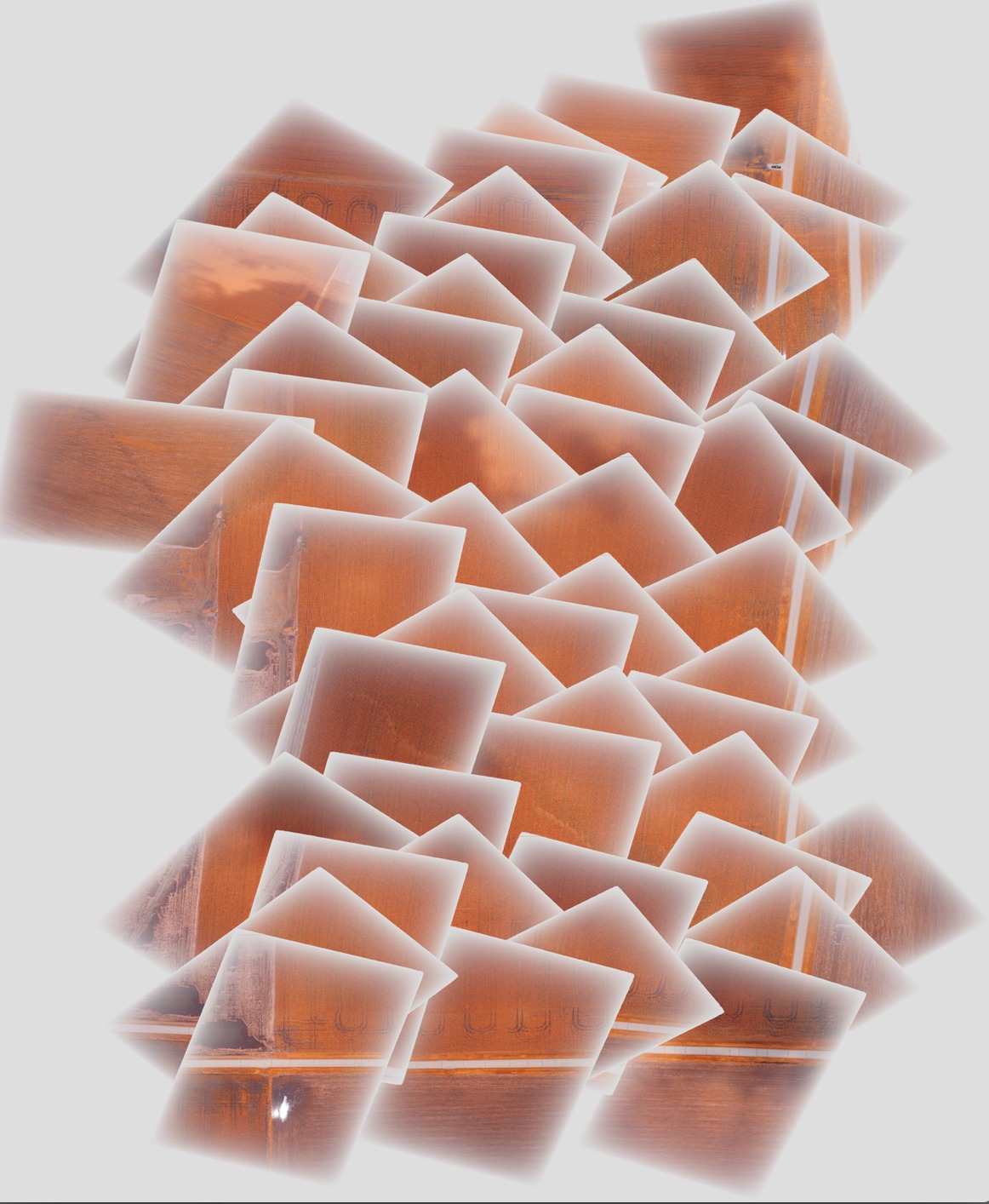
I am mosaicing some images with gdal and would like to improve the final result by using a fading / gradual alpha layer towards the edge of each image to remove the sharp edges in the middle of the mosaic. The issue I'm having is that the portion of each individual image with the gradual alpha layer is masking the images beneath it in the final mosaic, rather than being semi-transparent, as shown below:

Ideally I'd like one image to fade into the next using this gradual transparency.
The steps I perform to generate the mosaic are as follows:
Add gcps to the original images to geolocate them and orient them properly (done to each image in turn):
gdal_translate -of GTiff -a_srs EPSG:4326 -a_srs EPSG:4326 -gcp 1616 0 -88.2728612066 40.5175787437 -gcp <etc., etc.> <original_image_with_gradual_alpha>.tif <image_with_gradual_alpha_and_gcps>.tif
Warp the images to new geotiffs which are oriented properly (done to each image in turn):
gdalwarp -s_srs EPSG:4326 -t_srs EPSG:4326 -dstnodata 0 <image_with_gradual_alpha_and_gcps>.tif <warped_geotiff_with_alpha>.tif
Combine all the warped images together into one mosaic:
gdalbuildvrt -srcnodata 0 mosaic.vrt <warped_geotiff_with_alpha_root>*.tif
gdal_translate mosaic.vrt mosaic.tif
The image I linked is mosaic.tif.
gdalinfo for a sample input file:
Driver: GTiff/GeoTIFF
Files: dsc00562.tif
Size is 1616, 1080
Coordinate System is `'
Metadata:
  TIFFTAG_RESOLUTIONUNIT=2 (pixels/inch)
  TIFFTAG_XRESOLUTION=350
  TIFFTAG_YRESOLUTION=350
Image Structure Metadata:
  INTERLEAVE=PIXEL
Corner Coordinates:
Upper Left  (    0.0,    0.0)
Lower Left  (    0.0, 1080.0)
Upper Right ( 1616.0,    0.0)
Lower Right ( 1616.0, 1080.0)
Center      (  808.0,  540.0)
Band 1 Block=1616x1 Type=Byte, ColorInterp=Red
  Mask Flags: PER_DATASET ALPHA
Band 2 Block=1616x1 Type=Byte, ColorInterp=Green
  Mask Flags: PER_DATASET ALPHA
Band 3 Block=1616x1 Type=Byte, ColorInterp=Blue
  Mask Flags: PER_DATASET ALPHA
Band 4 Block=1616x1 Type=Byte, ColorInterp=Alpha
gdalinfo for the warped geotiff with gradual alpha layer:
Driver: GTiff/GeoTIFF
Files: geo_dsc00603.tif
Size is 1944, 1356
Coordinate System is:
GEOGCS["WGS 84",
    DATUM["WGS_1984",
        SPHEROID["WGS 84",6378137,298.257223563,
            AUTHORITY["EPSG","7030"]],
        AUTHORITY["EPSG","6326"]],
    PRIMEM["Greenwich",0],
    UNIT["degree",0.0174532925199433],
    AUTHORITY["EPSG","4326"]]
Origin = (-88.275727919349990,40.518829195724997)
Pixel Size = (0.000001599004942,-0.000001599004942)
Metadata:
  AREA_OR_POINT=Area
  TIFFTAG_RESOLUTIONUNIT=2 (pixels/inch)
  TIFFTAG_XRESOLUTION=350
  TIFFTAG_YRESOLUTION=350
Image Structure Metadata:
  INTERLEAVE=PIXEL
Corner Coordinates:
Upper Left  ( -88.2757279,  40.5188292) ( 88d16'32.62"W, 40d31' 7.79"N)
Lower Left  ( -88.2757279,  40.5166609) ( 88d16'32.62"W, 40d30'59.98"N)
Upper Right ( -88.2726195,  40.5188292) ( 88d16'21.43"W, 40d31' 7.79"N)
Lower Right ( -88.2726195,  40.5166609) ( 88d16'21.43"W, 40d30'59.98"N)
Center      ( -88.2741737,  40.5177451) ( 88d16'27.03"W, 40d31' 3.88"N)
Band 1 Block=1944x1 Type=Byte, ColorInterp=Red
  NoData Value=0
Band 2 Block=1944x1 Type=Byte, ColorInterp=Green
  NoData Value=0
Band 3 Block=1944x1 Type=Byte, ColorInterp=Blue
  NoData Value=0
Band 4 Block=1944x1 Type=Byte, ColorInterp=Alpha
  NoData Value=0
gdalinfo for the final mosaic:
Driver: GTiff/GeoTIFF
Files: mosaic.tif
Size is 5702, 6846
Coordinate System is:
GEOGCS["WGS 84",
    DATUM["WGS_1984",
        SPHEROID["WGS 84",6378137,298.257223563,
            AUTHORITY["EPSG","7030"]],
        AUTHORITY["EPSG","6326"]],
    PRIMEM["Greenwich",0],
    UNIT["degree",0.0174532925199433],
    AUTHORITY["EPSG","4326"]]
Origin = (-88.278946072799997,40.524561377550008)
Pixel Size = (0.000001509761581,-0.000001509761581)
Metadata:
  AREA_OR_POINT=Area
Image Structure Metadata:
  INTERLEAVE=PIXEL
Corner Coordinates:
Upper Left  ( -88.2789461,  40.5245614) ( 88d16'44.21"W, 40d31'28.42"N)
Lower Left  ( -88.2789461,  40.5142255) ( 88d16'44.21"W, 40d30'51.21"N)
Upper Right ( -88.2703374,  40.5245614) ( 88d16'13.21"W, 40d31'28.42"N)
Lower Right ( -88.2703374,  40.5142255) ( 88d16'13.21"W, 40d30'51.21"N)
Center      ( -88.2746417,  40.5193935) ( 88d16'28.71"W, 40d31' 9.82"N)
Band 1 Block=5702x1 Type=Byte, ColorInterp=Red
  NoData Value=0
Band 2 Block=5702x1 Type=Byte, ColorInterp=Green
  NoData Value=0
Band 3 Block=5702x1 Type=Byte, ColorInterp=Blue
  NoData Value=0
Band 4 Block=5702x1 Type=Byte, ColorInterp=Alpha
  NoData Value=0
I've included a sample image after each stage of the process and the final mosaic at in a dropbox link here - I can provide the entire image set if necessary.
