17

What iOS app from the iTunes App Store can I use to collect data (mainly points, perhaps photos) and later import them into my GIS?

I am mainly interested in an out-of-the-box solution, not develop one using any API. Bonus if it already connects to either my own WMS, WFS or Tile server.

Update: Free or paid doesn't matter. I just want the best option.

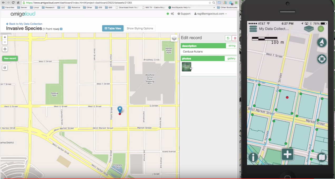
Update years later!: At that time, I needed to record points/lines/polygons and support workflows with relationships (e.g. if I needed to add signs to a light pole, they would not go in the light pole features but in a related table called signs). I ended up going through this rabbit hole, that once solved, was the genesis of the AmigoCloud mobile client (Open Source).

AmigoCloud Video

Here is a video of how it works: https://www.youtube.com/watch?v=lj6OeTZgzM8

7 Answers 7

4

I can recommend iGIS

It's free (at the moment), and is pretty easy to use. You can store your own tiles on it as well, but I don't think it can connect to other tile servers, it just uses the default Google maps or Google satellite. At the moment there is no WMS or WFS support.

It imports and exports Shapefiles, but under the hood it uses Sqlite. More information about its features are here

The pdf copy of the user manual is online as well here

Edit: Just to be clear, it support editing and collecting of points, lines and polygons in multiple layers. It also has rudimentary forms support to help with data entry.

0
3

GPS recording Apps for iPhone

Use can you the many apps that can 'make' tracks/waypoints using the iPhone

Specific to your needs is Locations Tagger

"It is primarily designed to map POIs for OpenStreetMap in a very fast and easy way. You can currently export your POIs via email in a gpx file and edit it with an OSM-editor of your choice. "

http://wiki.openstreetmap.org/wiki/Locations_Tagger

A comphensive list of all OSM related iPhone Apps is here (some free, some not) http://wiki.openstreetmap.org/wiki/Apple_iOS

0
3

Fulcrum from Spatial Networks is really nice, the form builder is top notch http://spatialnetworks.com/products/fulcrum/

If you need it synchronized with a local ArcGIS, we're adding a Fulcrum provider to Arc2Earth Sync in the next version

cheers

1

I second the Garafa GIS Kit sduggestion, I have worked with it extensively after trying many other options, and it's smooth. Has WMS support now too, and will save photos to camera roll georeferenced. It can be as simple as marking a waypoint and naming it, or as complex as setting up point, line, or polygon features with coded value lists, auto-incrementing ID's etc. but not at all hard to set up. Very "apple" feeling compared to some options (i'm looking at you iCMTGIS II/iGPSGIS II...)

Recently it's felt a bit buggier than it has been for the last few years and crashes/hangs a bit now and then, but never lost data, and I use it a ton.

0

GIS Cloud is a very useful app I believe can help you (currently free versions available).

You can only plot points not lines or polygons but you can add photos, sound and other information to those points.

0

Disclaimer: We are developer of this app

You can use https://inputapp.io It is based on QGIS and is available for iOS and Android. It is free and open source.

0
-1

I have heard good things about http://gis.garafa.com/, although I have not used it myself (no ip[hone|ad ])

Your Answer

By clicking “Post Your Answer”, you agree to our terms of service and acknowledge you have read our privacy policy.

Not the answer you're looking for? Browse other questions tagged or ask your own question.