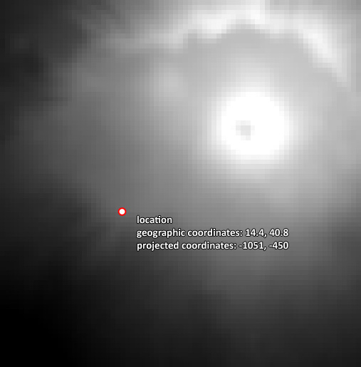
What I have is a SRTM 3 arc-second raster file in WGS84 geographic coordinate system (here is that file). I then project it to the Azimuthal Equidistant projection with GDAL:
gdalwarp -s_srs EPSG:4326 -t_srs "+proj=aeqd +lat_ts=40.81266 +lon_0=14.414252" -r near -of GTiff C:/vesuvius2_wgs84.tif C:/vesuvius2_aeqd.tif
I would like to know, how can I determine which point in the newly projected raster (C:/vesuvius2_aeqd.tif) corresponds to certain latitude,longitude location?
For example I would like to check where does the location of 14.4, 40.8 lay in the "C:/vesuvius2_aeqd.tif" file:
And for example it lays at -1051, -450 projected coordinates.
How can I calculate this?
EDIT:
Is it possible to know the exact pixel which corresponds to the required geographic coordinate location? For example, the 14.4, 40.8 geographic coordinate, corresponds to the pixel: 200x210 in the projected raster. Is that possible?

