I have, to start, a DEM raster and a shapefile, with random created points, within a given polygon. The DEM raster was clipped with that same polygon.
With the DEM raster, I used GRASS to perform neighborhood analysis (using "r.neighbors"), and I applied a buffer of 150m. Since the pixel size is 30x30m, the size I used was 5 (and I did not select the "circular neighborhood" option).
Then, I uploaded the new raster to QGIS, to perform DEM Terrain models analyses (Raster > Analysis > DEM (Terrain Models)). In "Mode" option, I used: Slope, TRI and Roughness.
My final objective is to atribute the value of "Slope", "TRI" and "Roughness" to each point of the shapefile.
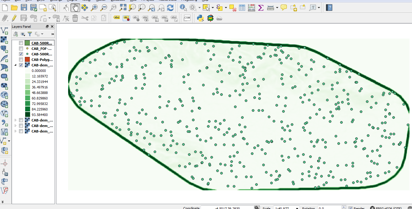
However, after creating "Slope", "TRI" and "Roughness", a kind of buffer (if it can be called this way) appeared surrounding the limits of the area, as you can see here:

The problem is, that buffer has an extremely high value that is not representative of the area, and some points fall into that buffer, so I obtain erroneous "Slope", "TRI" and "Roughness" values.
Do you have any idea of a solution for this problem?
