Are 'Nigerian Colony Coordinate System', MTM (Modified Transverse Mercator) and NTM (Nigerian Transverse Mercator) one and the same? How can I transform coordinates on 'Nigerian Colony Coordinate System' to UTM/WGS84?
2 Answers
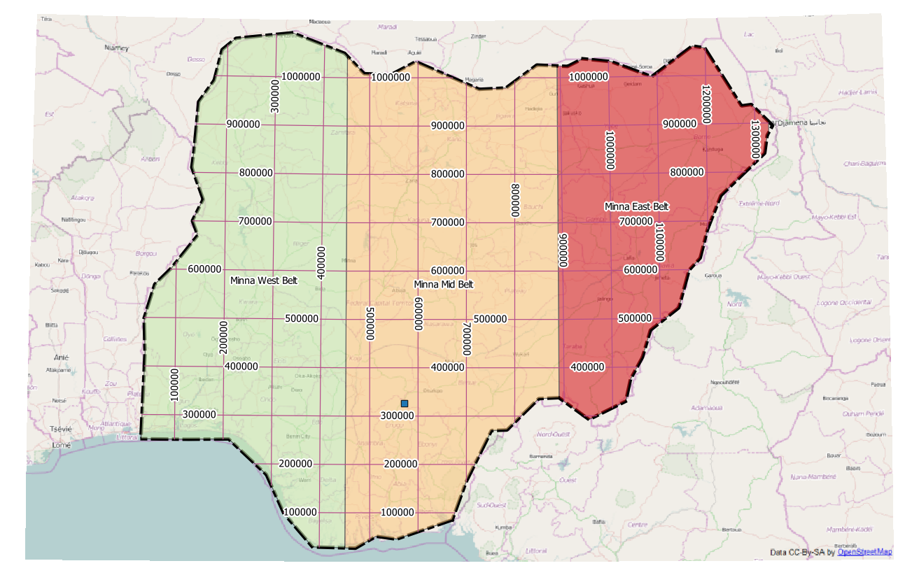
The Nigerian Transverse Mercator system combines three UTM zones to a contiguous coordinate system:
NTM uses meters as units, so you have to convert your feet data to meters before. The result 326262 North 572475 East can be found in the Minna Mid Belt zone. As an alternative, you could create a custom CRS with feet as units:
+proj=tmerc +lat_0=4 +lon_0=8.5 +k=0.99975 +x_0=670553.98 +y_0=0 +ellps=clrk80 +towgs84=-92,-93,122,0,0,0,0 +units=us-ft +no_defs
As a first guess, I have chosen US survey feet, but British surveyors may have taken a different conversion factor.
More information on Nigerian surveying can be found in http://www.asprs.org/a/resources/grids/02-2009-nigeria.pdf and http://icaci.org/files/documents/ICC_proceedings/ICC2005/htm/pdf/oral/TEMA2/Session%201/DR.%20M.E.%20UFUAH%202.pdf
Use the details for MTM in the document at the link above. You will need to create a transformation from MTM to UTM using the details of each projection.
Here is more information: http://desktop.arcgis.com/en/arcmap/10.3/tools/data-management-toolbox/create-custom-geographic-transformation.htm
-
This paper 'Grid & Datums, Nigeria' tells that Colony Coordinate System & MTM followed same projection system; so I can take both as one and the same. Central meridian scale factors of UTM & MTM are also given; but I am unable to proceed further - my limited knowledge. Also, I don't find any online tool for transforming MTM to UTM. I have a tool to transform NTM (Nigerian Trans Merc) to UTM. Can I use this tool to convert 'Colony Coordinates' to UTM, considering MTM and NTM are also same? For example: My point-1 has 'Colony coordinates' of 1070415 feet North, & 1878200 feet East. Commented Oct 14, 2016 at 11:15

