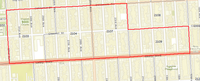
I have a county's worth of census tracts, and I need to combine adjacent tracts into larger polygons. Here's an example of what I'm looking for: This is four smaller tracts combined into a single large polygon.
I have used Dissolve, but that outputs a single polygon for the entire county which is not helpful for my purpose.
My preferred solution would take a county's worth of census tracts, say 500 or so, and combine them into 200 polygons, without gerrymandering any single group of tracts.
This could be done by hand but I will be doing this for multiple counties.
I'm using ArcMap 10.4.1
