Is there a resource for open data for the City of Montreal?
I am specifically looking for building footprints.
Is there a resource for open data for the City of Montreal?
I am specifically looking for building footprints.
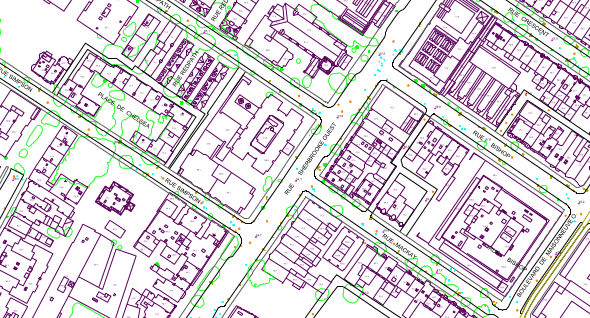
I'm not sure about shapefiles, but a basemap dataset ("cartographie de base") is provided here:
http://donnees.ville.montreal.qc.ca/dataset/cartographie-de-base
It's available in DWG format and contains a buildings layer:
I haven't downloaded to verify, but a google search finds:
https://www.concordia.ca/library/guides/geospatial-data/geodata.html.html :
"CanVec is a multi-source product coming mainly from the National Topographic Data Base (NTDB), the GeoBase initiative (www.geobase.ca) and the data update using Landsat 7 imagery coverage. CanVec provides topographic information in vector format and contains more than 90 topographical entities thematically organized into 11 distribution themes: Administrative Boundaries, Buildings and Structures, Energy, Hydrography, Industrial and Commercial Areas, Places of Interest, Relief and Landforms, Toponymy, Transportation, Vegetation and Water Saturated Soils."
Which can be downloaded @ http://ftp.geogratis.gc.ca/pub/nrcan_rncan/vector/canvec/shp/ Or more specifically for Quebec: http://ftp.geogratis.gc.ca/pub/nrcan_rncan/vector/canvec/shp/ManMade/canvec_50K_QC_ManMade_shp.zip (44mb)