2

enter image description here

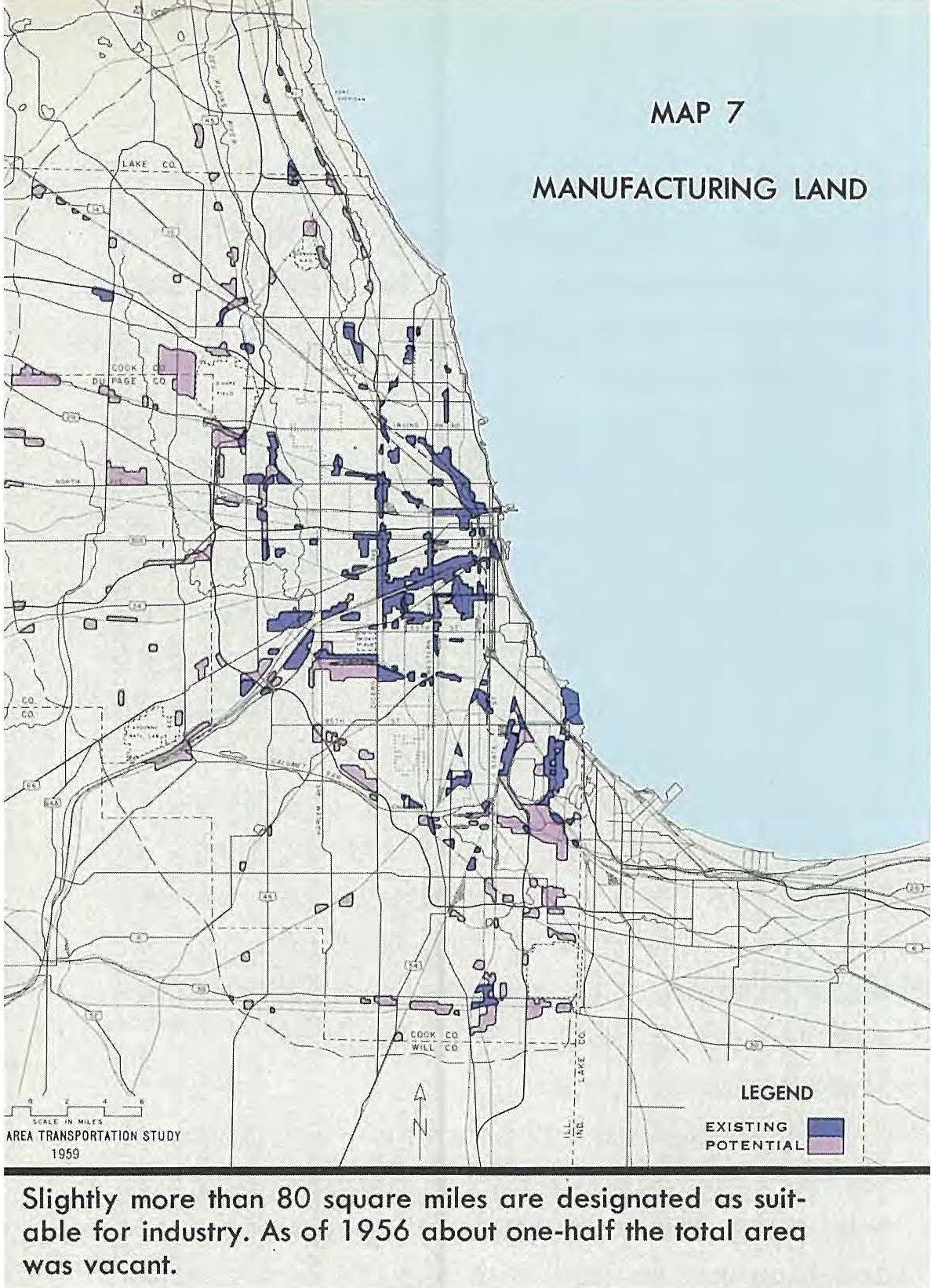
I would like to use the image of the map above to convert all the dark purple color (ie existing manufacturing land) to polygons. Other shapes and colors I would like to ignore. Furthermore, this is a map of Chicago, so I would like to be able to superimpose the jpg on the location of Chicago and then have the polygons created in the correct location. I don't mind trying to do this either in ArcGIS or Python. However when I try the basic tools like Raster to Polygon I don't have an option to select the color. Also I don't know what my license is but many of the options in my toolbox (like Spatial Analyst) say that I don't have a license for it.

Update:

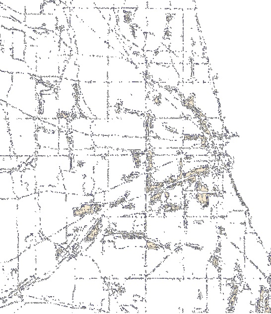
I have reclassified and converted the raster to polygons. Unfortunately as I didn't know what the values meant in the original reclassify I only used the Red Band as the values in that seemed to correspond with the Red value in the RGB value. After converting to polygons I got something like this:

enter image description here

As you can see there are big polygons in many of the right places (I superimposed the two pictures) but lots of small dots in other places especially where there are black (but not deep purple) lines like streets and boundaries. Can I do any better?

2
  • If you have access to Adobe Photoshop you have extract by colour and then use raster to polygon to complete the extraction in a gis.
    – Mapperz
    Commented Mar 27, 2017 at 14:15
  • I don't think I have access to Photoshop but if worse comes to worse I can get that thanks!
    – www3
    Commented Mar 28, 2017 at 20:28

1 Answer 1

2

You could simply make an intermediary raster by reclassifying your existing one so that all areas that are not purple (whatever code that is) become NoData and everything that you do want (purple) is coded 1 (or whatever). Then do polygonise the output of this operation.

Alternatively, polygonise the entire raster and the edit your polygon layer to delete every polygon that does not have the code you want.

EDIT:
To reclassify the data as per 1st paragraph, see the documentation and note the use of the missing_values parameter.

6
  • How would I classify a raster so that it is coded Nodata/1? I'm just learning ArcGIS. Polygonise everything works basically has thousands of polygons that get created so it would be a real pain to remove all of them.
    – www3
    Commented Mar 28, 2017 at 20:29
  • I've added a link to the relevant ESRI documentation. Commented Mar 29, 2017 at 10:54
  • Yeah that was one of the options I saw when I looked it up. Unfortunately reclassify uses the Spatial Analyst License, which I don't think I have.
    – www3
    Commented Mar 29, 2017 at 12:51
  • You could always use GDAL or QGIS. If your licence gives you raster calculator (I can't remember if you need SA for that) you can always do a conditional statement Commented Mar 29, 2017 at 13:49
  • I got the SA license. Now when I use reclassify it has a list of values and what I want to classify them as colors. I tried going in and changing the reclassified classes to the RBG value but I think I want a range as polygonize is only capturing the outline and other black, and not the entire shape.
    – www3
    Commented Apr 17, 2017 at 13:14

Your Answer

By clicking “Post Your Answer”, you agree to our terms of service and acknowledge you have read our privacy policy.

Not the answer you're looking for? Browse other questions tagged or ask your own question.