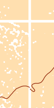
I have a set of 24 raster (2.5 x 2.5 km, tif) that displays vegetation (from las). However, there is a 10 m symmetric grid of unprocessed lines between the tiles.
Any way to interpolate these?
I have looked into ArcMap Focal Statistics tool, but I don't think this is a solution. I do want to "copy-paste" 5 m och each edge, move 5 m and finally mosaic these.
Ideas?
Rectify?
The elevation isolines are in shp and a later problem - snap?

