2

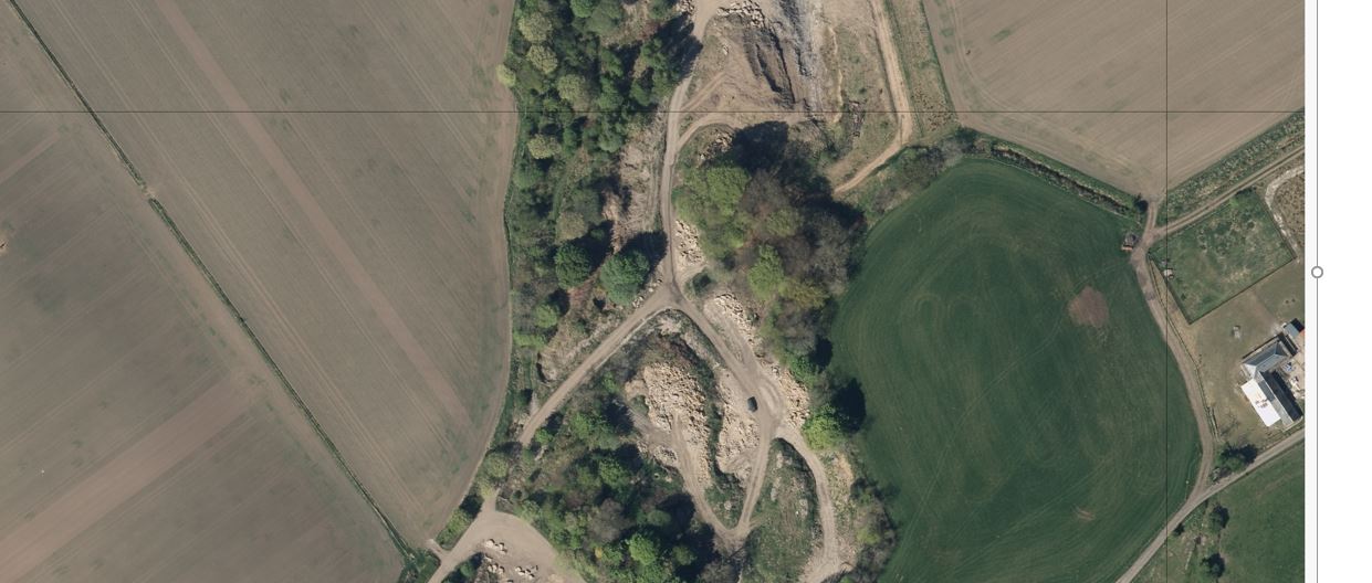
I am looking for a way to identify missing pixels in .tifs. For example, in the attached image there is a row and a column of missing pixels across the image.

The no data/ missing pixels after some investigation appear to have the value of 0 and appear across all three bands.

enter image description here

Can anyone recommend a way, via a piece of software/script, that could do this in bulk, say for 400-500 .tifs at a time, rather than having to do it manually/visually for each .tif?

Ideally, I'd like something that could give me a printed output in a .txt which lists all the .tifs that have missing pixels, which I could then investigate visually.

The software I have access to is; FME, ArcMap, QGIS, Python, and excel, however I may be able to get hold of something not on that list.

I have attempted a solution using Python with numpy and gdal (shown below), however I am new to python so my script is probably trash. I've played around with using numpy array and GDAL band statistics and I've got the expected results (both methods identify 0 values when expected), however I'm struggling to find a way to loop through a folder of 400/500 images and have some sort of summary statistics for all the images rather than 400/500 individual results.

import numpy as np
from osgeo import gdal

ds = gdal.Open("single.tif)

print "[ RASTER BAND COUNT ] : ", ds.RasterCount
for band in range( ds.RasterCount ) :
    band += 1
    print "[ BAND ] : ", band
    srcband = ds.GetRasterBand(band)
    if srcband is None:
         continue
    stats = srcband.GetStatistics ( True, True )
    if stats is None:
         continue

    print "[ STATS ] =  Minimum=%.3f, Maximum=%.3f" % (
                stats[0], stats[1])
myArray = np.array(ds.GetRasterBand(3).ReadAsArray())
print myArray

np.savetxt("Output.csv")

if 0 in myArray:
    print "yes"
else:
    print "no"
5
  • 3
    There are lots of different solutions. It would be helpful to know the following. What software do you have experience with and access too? What have you tried so far? Are these all cases of missing rows and columns? Finally if you have opened these tifs up in some image processing software what are the band values for the missing pixels?
    – RoperMaps
    Commented Jun 23, 2017 at 16:53
  • You can use Python's module name numpy to find the nodata values. Also with Python's os module it can help you to loop through all the .tif files in a particular folder and create a text file of files missing the pixel values Commented Jun 23, 2017 at 20:00
  • 1
    gdalinfo -hist -json gives you good output to write a little script to do that.
    – pLumo
    Commented Jun 26, 2017 at 15:28
  • Do the rows/columns count differ between the images with NoData and those that are normal?
    – Aaron
    Commented Jun 26, 2017 at 21:51
  • I believe the rows/columns count stays the same. For every image I've looked at they've all been 4000*4000.
    – JG_RS_GIS
    Commented Jun 28, 2017 at 15:52

2 Answers 2

1

I don't have a lot of aerial imagery to test this on just now, so I'm not 100% sure it'll work in your case. But it should get you closer to what you want.

I've used the rasterio library, which provides a very nice wrapper around GDAL and makes the code much simpler to write (and read).

This combines several things:-

  • a generator function which passes back the name of each TIFF file in a folder (and any sub-folders).
  • it opens each band in each file to generate a list of booleans, which represents which bands have NODATA values
  • if all bands have NODATA values, write to the console

Code :-

import os
import rasterio

def find_images(path):
    for root, dirs, files in os.walk(path, topdown=False):
        for name in files:
            if os.path.splitext(name)[-1] == ".tiff":
                yield os.path.join(root, name)

def main():
    for file_name in find_images("/path/to/your/images"): # <--- change this!
        with rasterio.open(file_name, "r", driver="GTiff") as source:
            no_data = source.nodata
            bands = source.read()
            got_nulls = [no_data in band for band in bands]
            if False not in got_nulls: # we want list elements to all be True
                print("File {} NodataValue {}, has {} Bands, Got Nulls {}".format(file_name, no_data, len(bands), got_nulls))

if __name__ == "__main__":
    main()

I've tried this on Python 2.7.12 using rasterio 0.26 and numpy 1.8.2.

As with most python experiments, I recommend using a python virtual environment to avoid having to install anything system-wide :)

1
  • Thanks for the python script - I think it could get me a lot closer to my end goal. However, I've been having a play around with rasterio and i've noticed that it's reading every pixel value in my .tifs as 255. So when I run your script it doesn't find any no data values/ values of 0 even when I know there are some in the tif. The simple test I was doing was; import rasterio src = rasterio.open("FilePath") msk = src.read_masks() print msk which would return 3 arrays with every value being 255. Is this a common with rasterio ? i.e as a new user am I missing something simple?
    – JG_RS_GIS
    Commented Jun 28, 2017 at 15:47
0

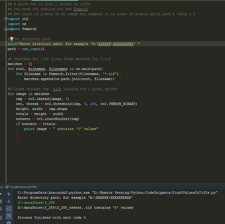
A colleague of mine (Steve Coupland) helped me with my question. Do people agree that this is a very efficient way to identify 0 value pixels in a tif? A quick way to find 0 values in tifss

However I'd like to take this script further, would anyone be able to advise on how I could add all my results into a LIST and then print the LIST to a CSV ?

1
  • You shouldn't be asking questions in an answer. Please copy the plain text if possible rather than a screenshots. It would probably be more helpful to those wanting to reuse your code snippet :)
    – gisnside
    Commented Jan 16, 2018 at 21:28

Your Answer

By clicking “Post Your Answer”, you agree to our terms of service and acknowledge you have read our privacy policy.

Not the answer you're looking for? Browse other questions tagged or ask your own question.