1

I'm using QGIS 2.16.1 - Nodebo.

I have a layer containing 200 polygons which has been styled on a categorical variable. All these polygons - constituencies, belong to regions. There are 6 regions. I want to automate making region level maps. [![enter image description here][1]][1]

Right now, I go to the query builder, and filter on a region and get the map like the one below and save it [![enter image description here][2]][2]

How can I automate tell QGIS to go through all regions and filter on that region and save that region map? (automation is what I'm looking for - through a Python script or Atlas Generation)

1 Answer 1

1

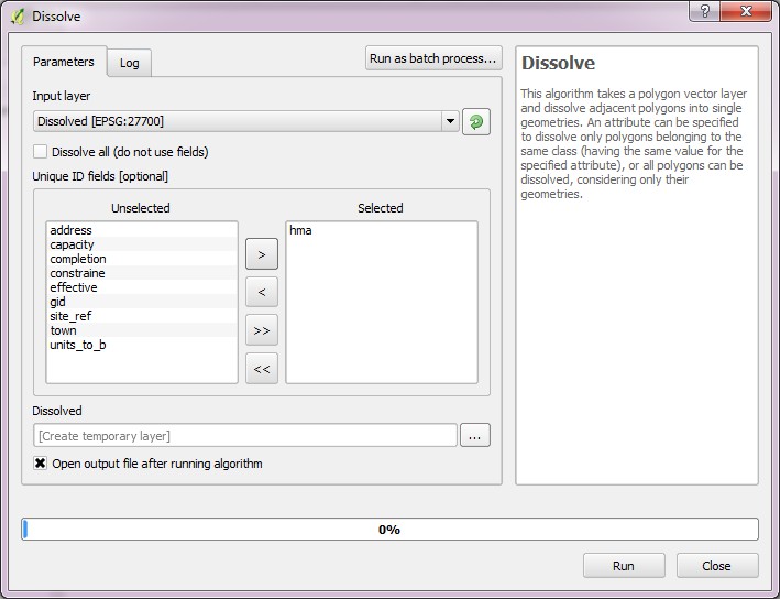
Create a temporary layer by dissolving the constituency layer by region to get a layer with six polygons.

Vector > Geoprocessing Tools > Dissolve

Uncheck the Dissolve all box and choose your region field and add it to the selected side. I left the option to create a temporary layer as is.

Dissolve tool

Use this new layer as a hidden coverage layer in the Atlas Generator. Keep the consituency layer on. Then each map output will contain all the consituencies in the region on display.

0

Your Answer

By clicking “Post Your Answer”, you agree to our terms of service and acknowledge you have read our privacy policy.

Not the answer you're looking for? Browse other questions tagged or ask your own question.