2

I have written a function that builds a new layer from from a gpx file which is read using pygpx. It runs and the new layer appears in QGIS with all the attributes correct.

Initially I created the layer with a crs of epsg:4326 since the data was lat and lon but when I try and cut and paste the points into my master table I get a message that no points were pasted and no hint why (I have looked in the log).

I now want to try to create the layer in my project crs to see if that fixes the problem but for which I presumably need to transform the points using tr = QgsCoordinateTransform(sourceCrs, destCrs) as described at Transforming single QgsGeometry object from one CRS to another using PyQGIS?

What I can't figure out is how specify the source and dest crs. I tried supplying strings -- there were no errors but it does not seem to do anything. The call to transform returns 0.

    tr = QgsCoordinateTransform('epsg:4326', 'epsg:2193')
    ...
    point = QgsGeometry.fromPoint(QgsPoint( wp.longitude, wp.latitude))
    point.transform( tr )
    fet.setGeometry( point )
2
  • Issue is because parameters in your QgsCoordinateTransform object are strings and they must be QgsCoordinateReferenceSystem objects.
    – xunilk
    Commented Jul 29, 2017 at 14:52
  • Note that there are other issues with this code in the question apart from the parameters to QgsCoordinateTransform. Don't copy anything from this! The code in Xunilk's answer works! Commented Jul 29, 2017 at 21:20

1 Answer 1

1

Issue is because parameters in your QgsCoordinateTransform object are strings and they must be QgsCoordinateReferenceSystem objects. To solve that (for an arbitrary point in New Zealand):

point = QgsPoint(175.8687, -38.7253)

#source crs
crsSrc = QgsCoordinateReferenceSystem(4326)
#target crs
crsDest = QgsCoordinateReferenceSystem(2193)

xform = QgsCoordinateTransform(crsSrc, crsDest)

pt = xform.transform(point)

print pt[0], pt[1]

it was printed:

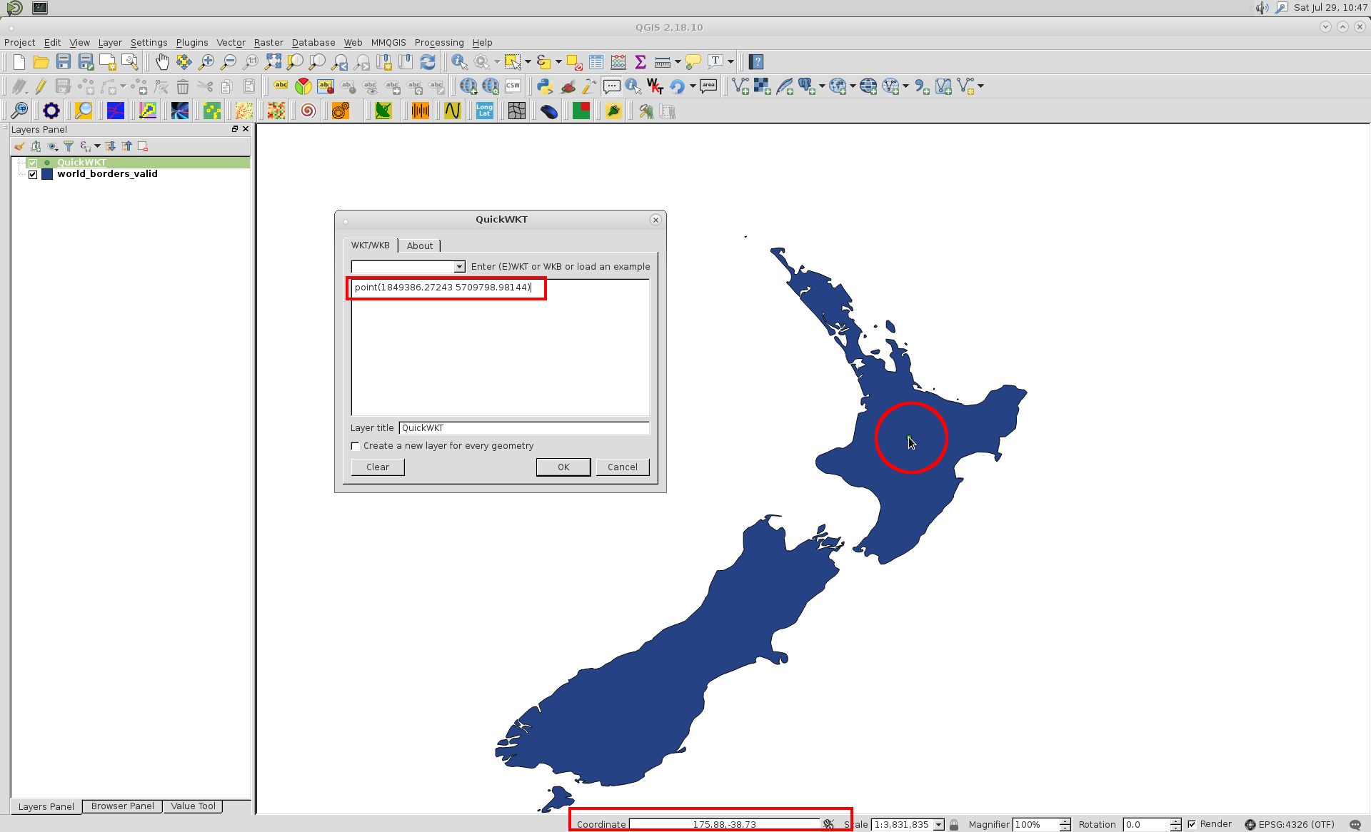
1849386.27243 5709798.98144

By using QuickWKT plugin, I visualized that point in QGIS (OTF enabled) and it is at right position:

enter image description here

Your Answer

By clicking “Post Your Answer”, you agree to our terms of service and acknowledge you have read our privacy policy.

Not the answer you're looking for? Browse other questions tagged or ask your own question.