0

I have a mosaic image with this file extension (.img) When I use image analysis in arcmap.10.4 to calculate NDVI I get values the following values

High: 3 Low : -5

NDVI values are supposed to be between -1.0 and 1.0 so this is wrong. Just wondering if it's even possible to calculate NDVI with an Erdas Imagine Image in arcmap.

11
  • The image is in DN or reflectance? Do you know image source? High and low values are often? Did you check histogram? It's posible that those values are from saturated pixels and yes, it's posible to calculate NDVI from a .img file
    – aldo_tapia
    Commented Aug 4, 2017 at 9:37
  • Hey The image has been processed for reflectance and its bee sources from the USGS site
    – Ray
    Commented Aug 23, 2017 at 3:21
  • Surface Reflectance Higher-Level Data or Level 1 (TOA reflectance)?
    – aldo_tapia
    Commented Aug 23, 2017 at 3:23
  • sorry I have no idea but when i zoom in to the map the image disappears and only appears to float about the map
    – Ray
    Commented Aug 23, 2017 at 4:08
  • When I load the bands at the start their values are appx 3000 High and - 3000 Low if that helps
    – Ray
    Commented Aug 23, 2017 at 4:44

2 Answers 2

1

I don't have a solution through ArcMap, but you can do it easily through Mapinfo Advanced.

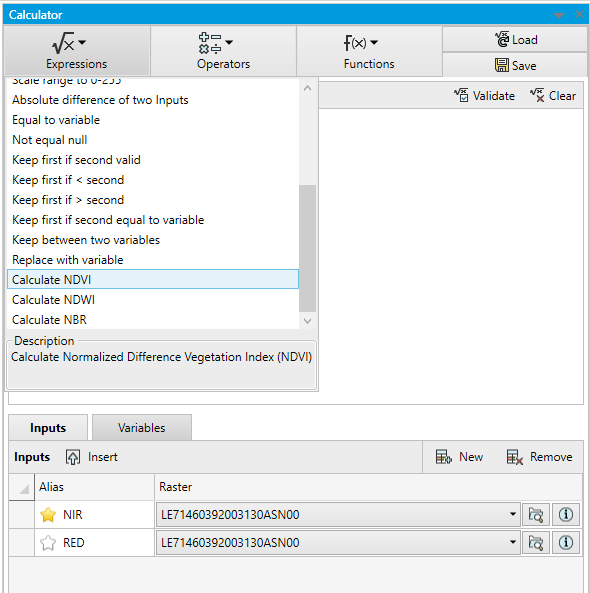
Just open up your file in Mapinfo and Go to Raster Tab. After that go to operations and select Calculator tool.

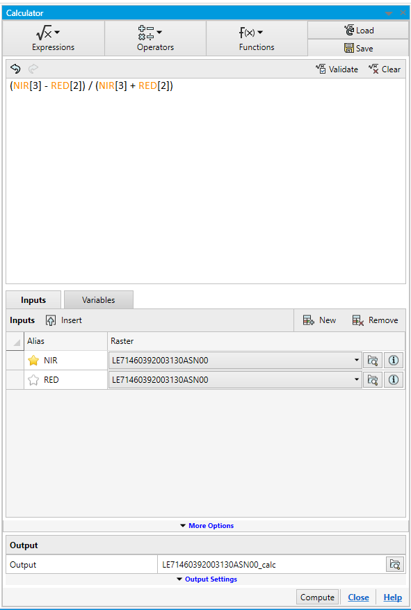
In calculator tool select Red and NIR band from the input. From Operations drop-down select NDVI. And click calculate button. enter image description here

enter image description here

The output that you will get will have NDVI range from -1 to 1. And it's fast.

So in the example i have a Landsat 7 img file. And i am running NDVI analysis on it.

Also please note that Mapinfo follows 0 based index for different bands. So Landsat 7 has NIR at band 4 then you will need to select 3 in calculator tool.

0

You should always run it in ERDAS before you could display in ArcMap, because both of them have different formats to display and problems...

For example, if you did mosaic in ERDAS, then do the NDVI in ERDAS or otherwise if you mosaic in ERDAS and then run NDVI in ArcMap you may run into problems.

If you mosaic in ArcMap, and run NDVI, do it in NDVI in Arcmap, otherwise you will have the same problem.

Your Answer

By clicking “Post Your Answer”, you agree to our terms of service and acknowledge you have read our privacy policy.

Not the answer you're looking for? Browse other questions tagged or ask your own question.