3

Zooming around Northern California on Google Earth reveals that Google have extremely high resolution imagery for not just cities but also rural and wilderness areas. I would guess it's something around ~10cm, which must be from aerial imagery not satellites, right? If you'd like see what I mean search for "Big Bar, CA" in Google Maps or Google Earth and fly around a bit. What's more, it seems to be collected annually (at least for the last two years).

I have no idea how much of the country has this high resolution coverage, I've only just noticed it in my neck of the woods. And I'm specifically interested in the Northern California imagery.

Does anyone know the source of this data? Or is there a way to find the source? Google Earth lacks the familiar copyright notices at the highest resolutions and I'm stumped about how to proceed beyond that. I might be interested in purchasing the data if I could find the source.

4
  • I think most of google earth imagery comes from Digital Globe (I could be wrong) with higher resolution imagery mosaiced into areas where it is available and they have added it. Worldview 4 is their most current satellite and offers 0.31 meters per pixel pan chromatic imagery. If this is Trinity county you could call the County Seat and ask to talk to their GIS department about aerial imagery. Where I am they are more than willing to talk to you. This is what I found and they have a online parcel viewer trinitycounty.org/index.aspx?page=284
    – Pete
    Commented Oct 12, 2017 at 21:36
  • The updates from 1997 to 2016 are here gearthblog.com/wp-content/uploads/2016/07/… load into Google Earth Desktop (Web crashes as network KML)
    – Mapperz
    Commented Oct 13, 2017 at 0:21
  • Thanks for the comments. @Mapperz : I loaded the kmz you linked into Google Earth but I'm not sure where to go from there. I see that 2016 has coverage for some portions of California but not Northern California like I'm looking for. But when I zoom into a region that I'm interested in the "Imagery Dates" according to GE are May 2016 so there is some discrepancy between the kmz you linked and the data in GE. 2015 in your kmz does overlap my area of interest but I don't know how to extract more information than that. does the kmz have copyright information somewhere that I'm not seeing?
    – Adam C
    Commented Oct 13, 2017 at 1:36
  • 1
    @AdamC you need to ask the authors gearthblog.com/about Frank or Tim.
    – Mapperz
    Commented Oct 13, 2017 at 1:42

1 Answer 1

1

A few years late, but I'm just adding my two cents because I stumbled upon this post and had the same question.

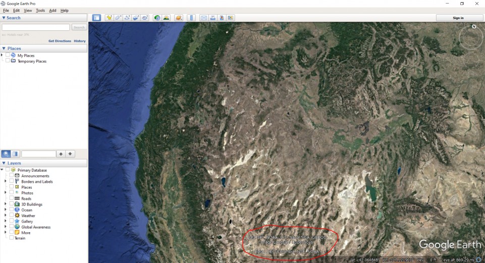
While not definitive, it seems like my version of Google Earth (v7.3.2.5776) lists the source on the bottom portion of the screen. Here's an example over the Western U.S. -- you can see it's a combination of Landast/Copernicus data and some U.S. governmental agencies (NSF, NOAA, Navy, etc.)

Location of source organization for Google Earth

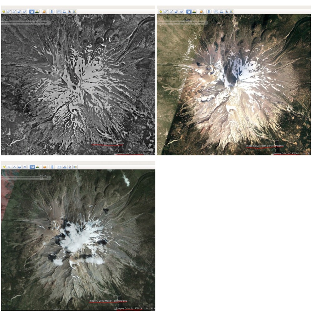
I've also found that looking at historical imagery can help. If you navigate to View and select Historical Imagery, a slider will appear in the screen that shows the imagery that existed at different periods of time. Depending on your spatial scale, you can see that there were different sources over time; for instance, here's some images of Mt. Lassen that are sourced by the USGS (08/24/1993), USDA (06/25/2006) and Maxar Technologies (09/19/2014).

Differences in sources over time

For more specific sources, it'll probably take some research. There's a link here where they discuss how images are collected, but it doesn't provide any context of the source. As suggested by @Mapperz above, it probably makes sense to reach out and ask on the Google Earth blog here.

Your Answer

By clicking “Post Your Answer”, you agree to our terms of service and acknowledge you have read our privacy policy.

Not the answer you're looking for? Browse other questions tagged or ask your own question.