Background: I have a shapefile with multiple polygons over a large area and then I also have GEOTiff image files. I want to crop the TIFF files with each of the polygons. The problem is that when I use raster::intersect to try and do it, I get the error:
Error in .local(x, y, ...) : extents do not overlap
This is my (pseudo)code for loading the shapefile and selecting a polygon from that shapefile:
 Mineralrights.shape<-readOGR(dsn = "C:/Users/blablabla/Shapefiles",layer = "Mineral Rights")
 Mineralrights.shape <- spTransform(Mineralrights.shape, "+proj=longlat +ellps=WGS84 +towgs84=0,0,0,0,0,0,0 +no_defs")
 tempshape <- Mineralrights.shape[Mineralrights.shape$GID == "2097674",]
And this is my (pseudo)code for loading the GEOTiff as a raster:
  Aerialfiletocheck <- raster(paste0(getwd(),"/","2923AD_06_2014_783.tif"))
  projection(Aerialfiletocheck) <- projection(tempshape)
I don't think the projections is the issue here, since all the source files (shapefile and TIFFS) uses a standard WGS84 ellipse, I just set the projections explicitly for safety. Then call:
clip <- raster::intersect(Aerialfiletocheck,tempshape)
And this is when I get the error about the extents that do not overlap. To be sure, I tried to simplify the GEOTiff to just its extent and then plotting that over the specific polygon I have selected:
  raam <- projectExtent(Aerialfiletocheck,"+proj=longlat +ellps=WGS84 +towgs84=0,0,0,0,0,0,0 +no_defs")
  raam.shape <- as(raam@extent, 'SpatialPolygons')
  plot(raam.shape)
  plot(tempshape,add=T)
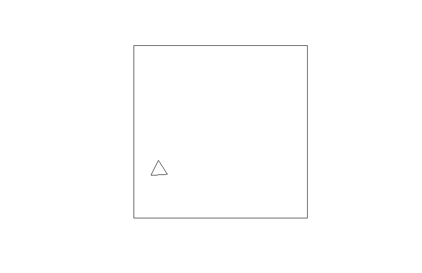
Yielding this plot, where the large rectangle is the extent of the GEOTiff and the funny triangle being the polygon I selected. 
These are the parameters requested
 > Aerialfiletocheck@extent
    class       : Extent
    xmin        : 24127.25
    xmax        : 29297.25
    ymin        : -3248250
    ymax        : -3242397
 > tempshape@bbox
            min       max
    x  23.25377  23.25875
    y -29.33836 -29.33380
Problem: To me it looks like their extents very much overlaps, hence my question: Does the inputs' extent have to be identical for raster::intersect to crop a RGB GEOTiff? That would make no sense to me, because the whole idea of raster::intersect is to "crop" the one with the other, which would imply that their extents will overlap, but not necessarily be identical.
What else have I tried: 1) I have replaced the raster with another polygon and then get the expected result.
2) I have tried base::cropwhich give the same error, which I expected because I think when one input is a raster, intersect just calls crop
3) I have tried rgeos:gIntersection which results in an error about the raster not having a proj4string slot, which makes no sense to me.
4) I have read these posts (and many others): Extracting intersection areas in R

Aerialfiletocheck@extentandtempshape@bboxprojection(Aerialfiletocheck) <- projection(tempshape)somehow not working?