55

Upon searching for the OpenLayers plugin, it shows that this plugin is incompatible with version QGIS 3.0. Will this be updated? Is there another way to add Google imagery or any other aerial imagery other than through this plugin?

I noticed the OpenStreetMap layer I had been using with QGIS 2 is still working now that I am using QGIS 3, but the Google Satellite layer no longer appears.

1
  • 5
    My number 1 tip for using QGIS: never touch the openlayers plugin. It causes all sorts of bugs and instability in qgis. It's just not worth the wasted time.
    – ndawson
    Commented Feb 27, 2018 at 9:37

6 Answers 6

70

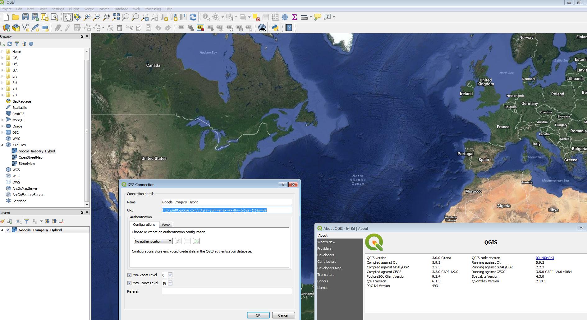
In QGIS 3 use the XYZ Tiles in Data Browser

use

http://mt0.google.com/vt/lyrs=y&hl=en&x={x}&y={y}&z={z}&s=Ga

enter image description here

12th March 2018 update

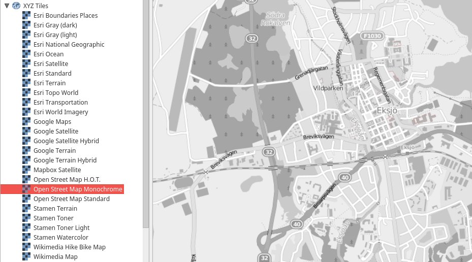
There is a python script that will load in multiple xyz tiles available here https://raw.githubusercontent.com/klakar/QGIS_resources/master/collections/Geosupportsystem/python/qgis_basemaps.py (full credit is to Klas Karlsson https://twitter.com/klaskarlsson/status/972757121933733889)

enter image description here

4
  • Totally illegal to consume directly the Google Maps tiles without using Google own API. That's why people use QGIS OpenLayers plugin as it uses Google Maps API internally to make the URLS calls. You avoid doing illegal things although technically not needed...
    – ThomasG77
    Commented Mar 22, 2018 at 22:38
  • 2
    @ThomasG77 the terms changed in January 2018 and documentation links to Map URLs developers.google.com/maps/documentation/urls/guide You don't need a Google API key to use Maps URLs.
    – Mapperz
    Commented Mar 23, 2018 at 0:48
  • 6
    The API key is not the issue. It's the TOS e.g developers.google.com/maps/terms#section_10_1 "You will not access the Maps API(s) or the Content except through the Service. For example, you must not access map tiles or imagery through interfaces or channels (including undocumented Google interfaces) other than the Maps API(s)."
    – ThomasG77
    Commented Mar 24, 2018 at 21:44
  • @ThomasG77, Section 10 of those terms began by saying: "Except as expressly permitted under the Terms, or unless you have received prior written authorization from Google", so "Totally illegal" I don't think it's a proper description. However, the terms changed a short time later. Commented Jan 2, 2020 at 1:01
25

Qgis 3 has a new plugin architecture so plugins are not immediately compatible with this new version. From the source repository it seems they wait for the official release of QGIS 3 to produce a new version of the plugin.

Beside this you have now the option to use XYZ Tile source to declare some slippy maps. for example you can use http://tile.openstreetmap.org/{z}/{x}/{y}.png for openstreetmap.

You'll find a bunch of resources in https://qms.nextgis.com (look for TMS)

3
  • Using the OSM link above, the XYZ Tiles are too small to read if you use a HDPI resolution (i.e. 3200x1900) monitor.
    – Colin
    Commented Mar 29, 2018 at 8:07
  • You'll need high resolution (aka retina) source. Some information here gis.stackexchange.com/questions/276323/…
    – Billy34
    Commented Mar 29, 2018 at 12:57
  • The retina sources are also too small using HDPI monitors. They worked for me a couple of days ago, still with small text, but I cant get them to render now.
    – Colin
    Commented Mar 31, 2018 at 2:55
13

The QuickMapServices (or QMS) Plugin makes it very easy to add basemaps from many different sources to your QGIS 3 project.

By default you get quite a few basemaps, but you can add hundreds of additional user-contributed basemaps by going to QuickMapServices --> Settings --> More Services --> Get Contributed Pack

Use the Search QMS tool to quickly locate basemaps.

1
  • 1
    QMS is excellent -- great range of built-in data sources, and far easier than having to manually specify tileservers with XYZ Tiles via databrowser. Commented Nov 5, 2018 at 11:31
5

I've made a generic script to load from CSV any XYZ tiles

It's more generic than the one by Klas Karlsson (not hardcoded content) but you will need to set additional layers on your own as the default CSV provided does not contain a lot of default basemaps.

QuickMapServices, an alternative plugin to QGIS OpenLayers plugin, is now compatible with QGIS 2.x & 3.0 as stated in this blog post announcement

3

There now is an experimental version of the OpenLayers plugin available from the QGIS Python Plugins Repository, which is compatible with QGIS from version 3.0.1 upwards.

1
  • I confirm the plugin works with qgis 3.4.7
    – EricC
    Commented May 2, 2019 at 18:58
1

To download OpenStreetMap vector data you can use OSMDownloader. It downloads .osm files and load them automatically into QGIS3. I just finished the porting. Check here how to use it: https://github.com/lcoandrade/OSMDownloader/wiki

Your Answer

By clicking “Post Your Answer”, you agree to our terms of service and acknowledge you have read our privacy policy.

Not the answer you're looking for? Browse other questions tagged or ask your own question.