Is it possible to reproject an image in earth engine to non-EPSG defined coordinates? In particular either Goode Homosline (SR-ORG:7619) or Mollweide (ESRI:54009). Passing either to .reproject() returns an error stating that the CRS cannot be parsed.
1 Answer
Yes, Earth Engine can reproject images to non-EPSG coordinate reference systems.
Earth Engine uses the Java GeoTools library for coordinate system transformations which supports the Coordinate System Well-Known Text (WKT) format, and a set of base projections.
Mollweide
The ESRI:54009 World Mollweide coordinate reference system (CRS) has a WKT representation that includes a base projection entry PROJECTION["Mollweide"] that is supported by GeoTools. The following Earth Engine code shows how to reproject to World Mollweide:
// Get a sample image (Landsat 8) which uses a UTM projection.
var image = ee.Image('LANDSAT/LC08/C01/T1_TOA/LC08_044034_20170614');

// Get the bounding coordinates of the Landsat image.
var bounds = image.geometry().bounds().getInfo()['coordinates'];

print('Original image (UTM) URL:',
  image.getThumbURL({
    bands: ['B4', 'B3', 'B2'],
    min: 0,
    max: 0.3,
    dimensions: '400'
  })
);

// Project the image to Mollweide.
var wkt = ' \
  PROJCS["World_Mollweide", \
    GEOGCS["GCS_WGS_1984", \
      DATUM["WGS_1984", \
        SPHEROID["WGS_1984",6378137,298.257223563]], \
      PRIMEM["Greenwich",0], \
      UNIT["Degree",0.017453292519943295]], \
    PROJECTION["Mollweide"], \
    PARAMETER["False_Easting",0], \
    PARAMETER["False_Northing",0], \
    PARAMETER["Central_Meridian",0], \
    UNIT["Meter",1], \
    AUTHORITY["EPSG","54009"]]';

var proj_mollweide = ee.Projection(wkt);
var image_mollweide = image.reproject({
  crs: proj_mollweide,
  scale: 300
});

print('Projected image (World Mollweide) URL:',
  image_mollweide.getThumbURL({
    bands: ['B4', 'B3', 'B2'],
    min: 0,
    max: 0.3,
    region: bounds,
    dimensions: '400'
  })
);
(Link to the code: https://code.earthengine.google.com/5b50ad250e83ec994335615c4db72a00)
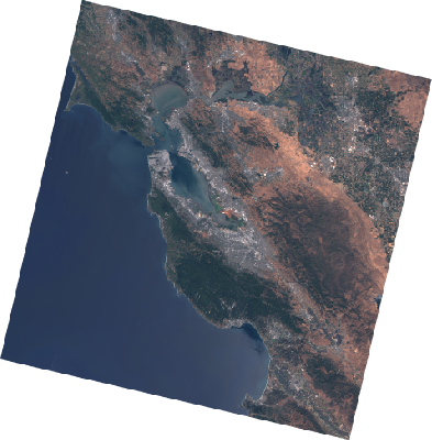
The original image in a UTM projection looks like:

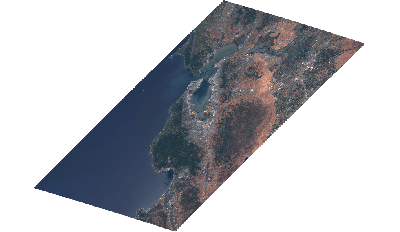
While the World Mollweide projected images looks like:

Goode Homosline
By contrast the SR-ORG:7619 (Interrupted Goode Homosline) has a CRS WKT that includes a base projection entry PROJECTION["Interrupted_Goode_Homolosine"] that is not supported by GeoTools, so it is not supported by Earth Engine.
