I have such a geojson file and drag'n'drop it into QGIs:
{"type":"FeatureCollection","features":[{"type":"Feature","properties":{"name":"osm","desc":"osm"},"geometry":{"type":"LineString","coordinates":[[2.1377253,13.4948849],[2.0954585,13.519405],[2.0966719,13.5244217],[2.084995,13.5268805],[2.0043786,13.5910286],[1.9499489,13.6159676],[1.9244407,13.6178174],[1.8981672,13.6418839],[1.8588131,13.6542176],[1.8528482,13.6651903],[1.8221349,13.6777434],[1.8116032,13.691144],[1.7824779,13.7051777],[1.657833,13.7973294] ... [0.5005446,15.6685503]]}}]}
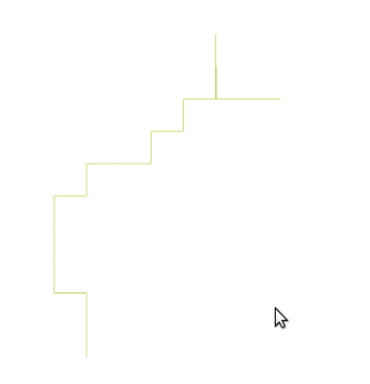
When loading it in QGIS 2.8.6 I get very strange results:
(very low zoom)
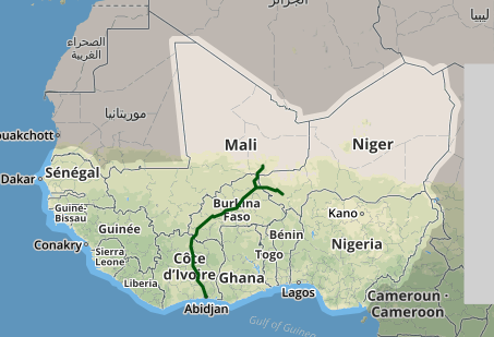
In leaflet the data looks like this:
So it seems like the data is important on a resolution of several 100 kilometers.
Why is that ?


