0

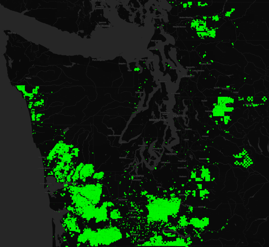
I have a map I generated that roughly estimates timber industry land ownership (designated by the green on the map) in the counties surrounding the Salish Sea in the US state of Washington:

map of timber industry lands in Salish Sea region

I want to remove parcels below a certain area threshold (e.g "only show parcels larger than 20 acres"). But the problem with this is that many of the larger timber tracts are broken up into a bunch of smaller adjacent real property parcels. Thus, a timber company might have a contiguous 20 acre parcel that is broken up into four 5-acre parcels, and a simple "features where area > 20 acres" search would miss this parcel.

So what I am trying to figure out how to do is show any parcels that are either (a) larger than 20 acres or (b) part of a connected cluster/group of parcels that collectively cover more than 20 acres.

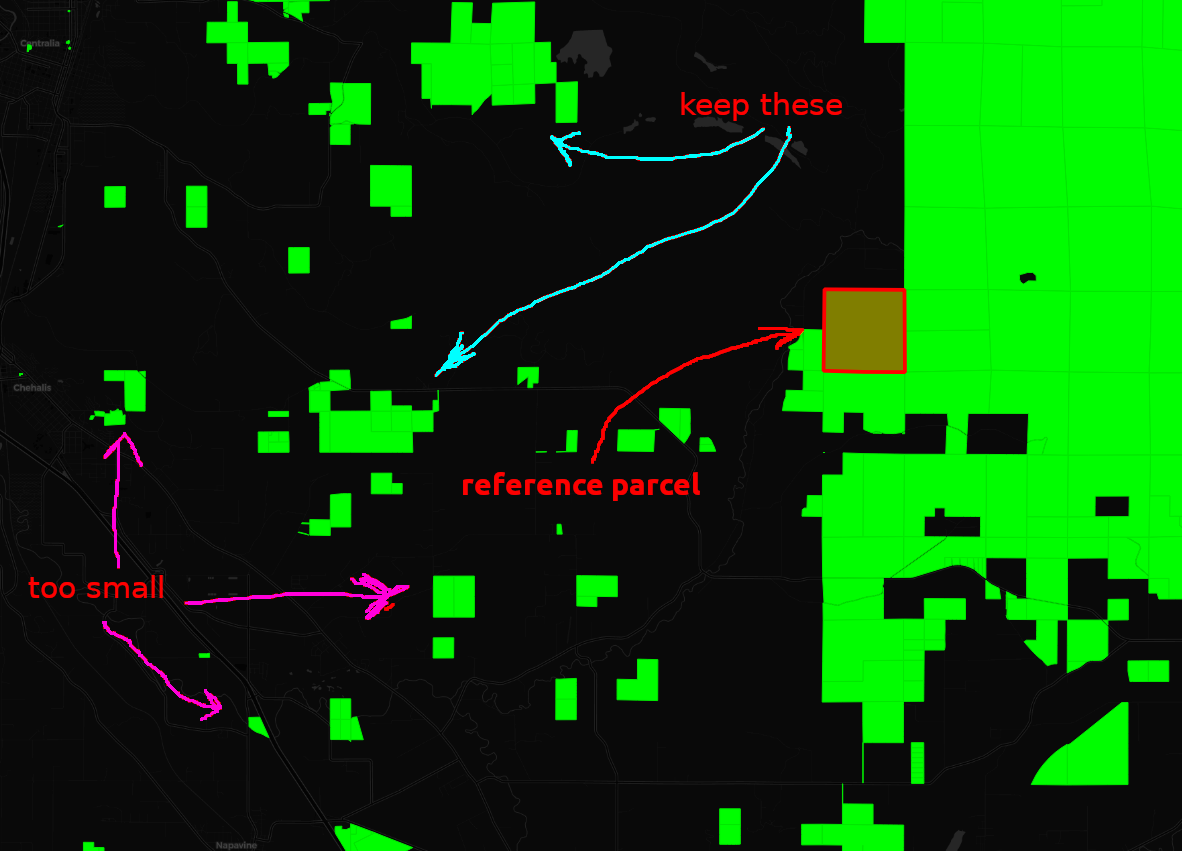
For example, zooming in on part of the above map:

enter image description here

I want to filter out any parcels that are smaller than the reference parcel, unless they are part of a larger cluster of adjacent/connected parcels (such as the one I labeled with the blue arrows in the image), and generate a new layer with these smaller, disconnected parcels removed.

Is there an easy way to do this through QGIS?

If not, does anyone have any ideas for Python libraries or command-line utilities I could use to achieve this?

4
  • I see that someone downvoted this, and would appreciate guidance on how my question could be improved ... was it unclear what I'm asking? not enough information? bright colors annoying?
    – J. Taylor
    Commented Jun 11, 2018 at 10:33
  • People downvote for many reasons, and the criteria for downvoting are described in the downvote tooltip. I've seen people say that they will always/often downvote when they see the downvotes of others being questioned.
    – PolyGeo
    Commented Jun 11, 2018 at 23:59
  • PolyGeo - I'm aware of what the criteria for downvoting are, but don't see how my question meets any of them ... Either way, I don't really care if people downvote me for asking, because I'm not trying to win points (just trying to figure out how to do the thing I described above). I'll just ask on the QGIS mailing list ¯_(ツ)_/¯
    – J. Taylor
    Commented Jun 12, 2018 at 2:57
  • One thing I see is that it asks two questions, although that is more often a reason for a close vote as too broad. Someone without rep to close vote might downvote as an alternative and consider too broad for focused Q&A as being not useful.
    – PolyGeo
    Commented Jun 12, 2018 at 3:05

1 Answer 1

1

You could use GRASS' v.dissolve on a common field value, filter out the smaller areas, and then use select by location from the vector menu to find which of your original parcels overlap the filtered areas.

1
  • Ah thanks! The term "dissolve" is exactly what I needed. I used GRASS v.dissolve in Processing toolbox, as you suggested. Then I just had to filter out all features of the generated layer less than N acres. Appreciate the help :)
    – J. Taylor
    Commented Jun 13, 2018 at 1:20

Your Answer

By clicking “Post Your Answer”, you agree to our terms of service and acknowledge you have read our privacy policy.

Not the answer you're looking for? Browse other questions tagged or ask your own question.