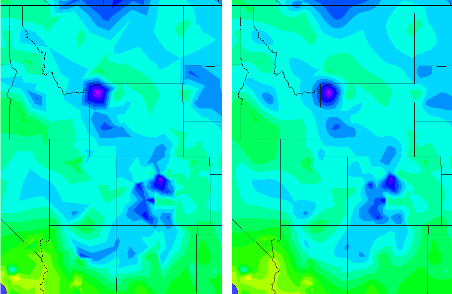
Using the ArcGIS tool "TIN to Raster" (3D Analyst Tools --> Conversion --> From TIN) to work on my Digital Elevation Model I was wondering about the interpolation methods.
I can choose either or:
- linear interpolation ("Default. Calculates cell values by applying linear interpolation to the TIN triangles")
- natural neighbors interpolation ("Calculates cell values by using natural neighbors interpolation of TIN triangles...The algorithm used by the Natural Neighbor interpolation tool finds the closest subset of input samples to a query point and applies weights to them based on proportionate areas to interpolate a value")
[From ESRI Dokumentation]
So far, I understand the technical difference between both and how the algorithms work. But I am struggling how to interpret that knowledge. If I choose one of the interpolation methods, what consequences does the choice of one method mean to my result? Are there use cases, when to take either the one or the other method? What are advantages or disadvantages of each method?

