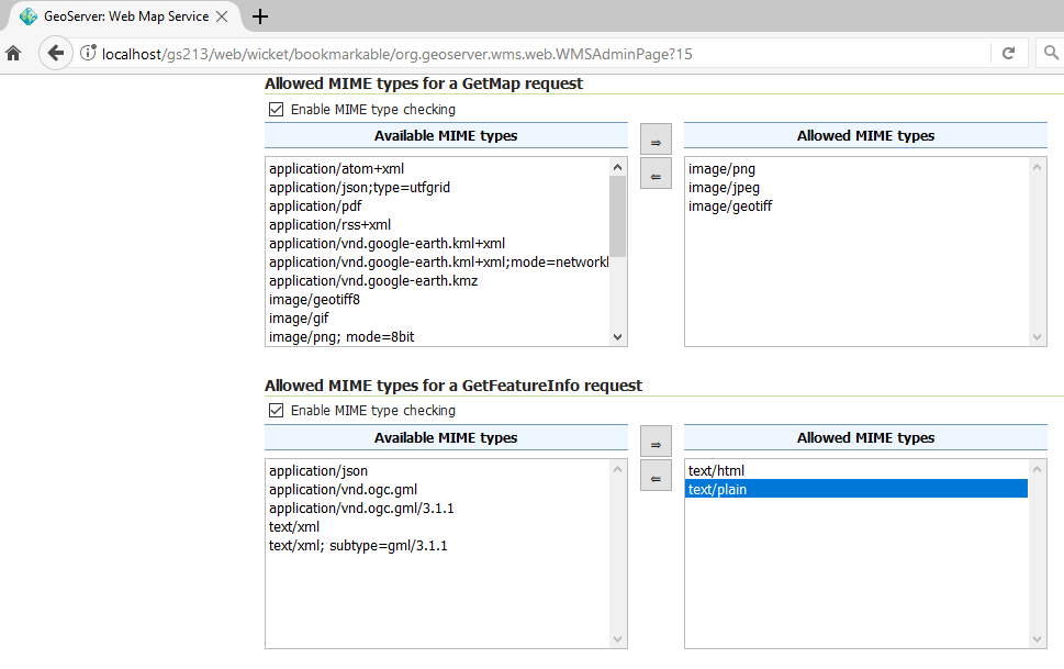
I have published a couple of layers on my Geoserver.
To be complaint with the T&C of my data provider, I need to block the access of some of those layers as Vector data. Hence I have already blocked the WFS services on these Layers.
I came to know that even on the WMS service, you can get Vector Data, if you use GeoRSS and some of the other formats.
How do I block GeoRSS, SVG & UTFGrid as formats in the WMS Service?

