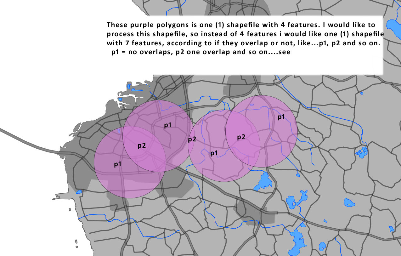
I would like to split a shapefile in qgis according to how the polygons overlaps.
See pic for explanation:

I think I found a method.
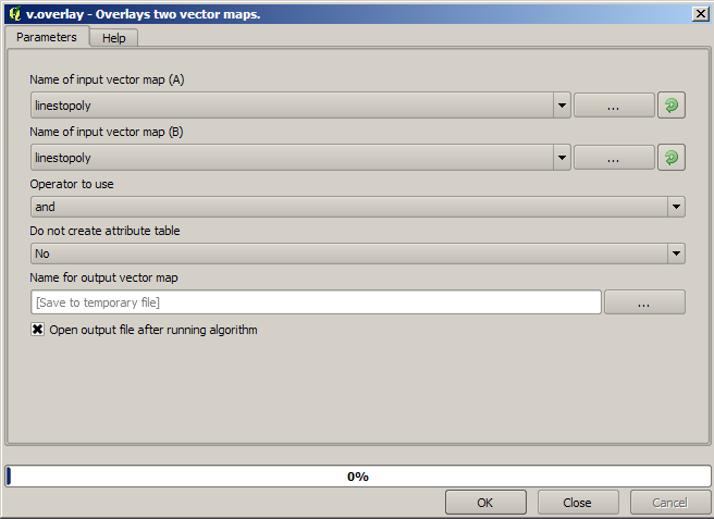
It s a grass function included inside the sextante plugin.
See the screenshot.
I did a test with a shapefile that looked like yours.
More Details:
The tool is Located in Sextante toolbox > Grass Commands > Vector > v.overlay
Just open the tool and use the default parameters and you get the results in a new layer

I am more familiar with ArcGIS than QGIS but I just did a brief search and think this would work:
1) Use the Union tool (as suggested by Darren Cope) to create your 7 features.
2) Under Data Management Tools use "Join attributes by location" and take the sum of the number of your original (purple in your map) polygons that overlap your new 7 features.
Thus where there is only 1 original poly, the new field = 1, where there are 2 polys, field = 2 and so on.
The standard QGIS Georeferencing tool "Union" will give the same result.