0

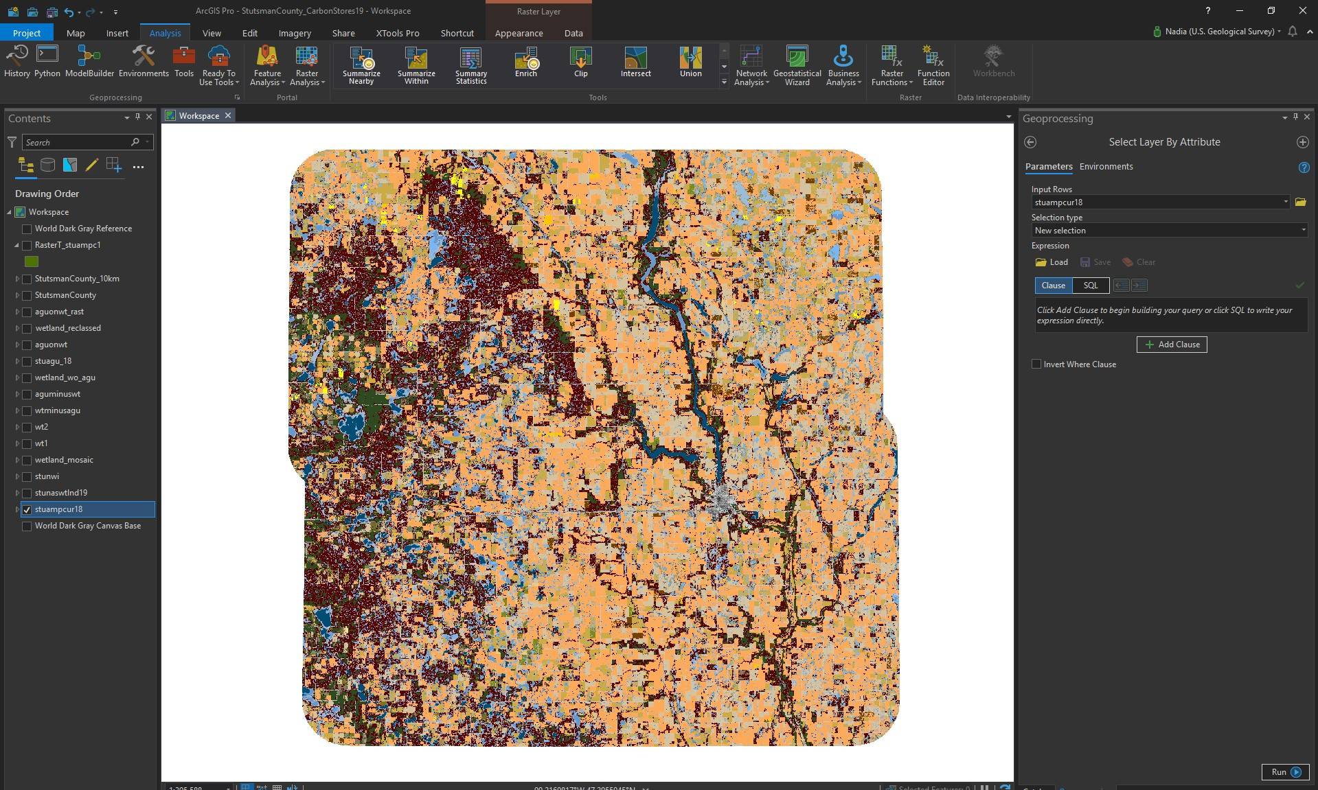
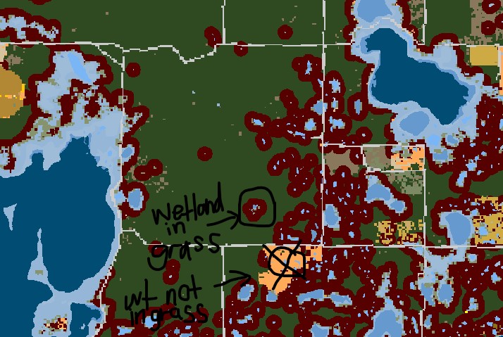
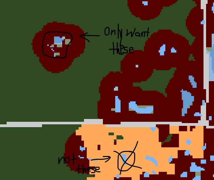
I have a land-cover map for an area in which I want to identify certain attributes that fall within a category. I want to select the shapes that represent wetlands that are in a grassland area. To do this I have tried any different methods such as separating the attributes into their own layers and subtract from the other, difference or minus, and tried to put one on top of another using the mosaic tool but neither worked. I am now thinking it may be best to write a specific query that would allow me to select an attribute within a selection of attributes. If I selected grassland, what can I do next to select wetlands are are within that selection of grassland? There are not options on the drop down menu for selection type that would allow me to do so. What can I do?

I am using ArcGIS Pro 2.3.2 and some screenshots are included with my question.

enter image description here

enter image description here

enter image description here

6
  • 1
    Are the grassland and wetland values coming from the same initial raster?
    – SMiller
    Commented Jun 5, 2019 at 16:42
  • @smiller Yes, the grassland and wetland values are from the same raster. Commented Jun 5, 2019 at 17:41
  • 1
    Not sure, but something to try: reclassify the raster once for grassland, then again for weland. (1s if desired value, 0 if not). Polygonize the rasters then look for "within" relationship.
    – SMiller
    Commented Jun 5, 2019 at 18:27
  • @smiller Thank you for your input, I have done up to reclassifying the rasters and giving them the desires value and I have polygonized them as well, however I am having trouble on how to look for the within relationship. Should I give them a similar value and then join the tables and use a query to identify the wetlands? Commented Jun 5, 2019 at 19:11
  • 1
    Do you now have two feature classes, with polgyons in them? I would just use the Select by Location to look for wetlands that are within grasslands.
    – SMiller
    Commented Jun 5, 2019 at 19:39

1 Answer 1

0

I got the output I wanted! To get to having the attributes I wanted, I separated the land cover types from the original land cover map. So I had a wetland layer and a grassland layer both rasters from the original raster, then I converted then to polygons. After they were polygons, I dissolved the layers so that all of the values became one from the separate values they had for example the specific type of grassland or wetland. Finally I did a spatial join to join the dissolves grassland layer to the dissolved wetland layer as my target feature with a join operation of join one to many. I did not keep the target features and used the grid code as the way to control which attribute table will be in the output feature class. I used boundary touches as my match option and after I ran the tool and I checked if the wetlands so in fact only appear if they are within grassland area and it worked! Thank you everyone for your input, I appreciate it.

Your Answer

By clicking “Post Your Answer”, you agree to our terms of service and acknowledge you have read our privacy policy.

Not the answer you're looking for? Browse other questions tagged or ask your own question.