4

I am using QGIS 3.8 (or 3.4) with the vector tile plugin: https://github.com/geometalab/Vector-Tiles-Reader-QGIS-Plugin I've also installed the vector tiles plugin for GeoServer 2.15.1.

The problem that I am facing is how to integrate these 2 plugins. The tutorial on GeoServer handles how to integrate OpenLayers with Vector tiles.

But the QGIS plugin requests a:

  • TileJSON url
  • and/or a GL Style JSON url

I cannot find in the GeoServer documentation anything about what these URL's might be.

Interface

I've tried a couple of urls based on what I see Openlayers is doing, but no progress.

Does anyone have an idea of how to make this work?

EDIT: added extra picture for Dror: xtr
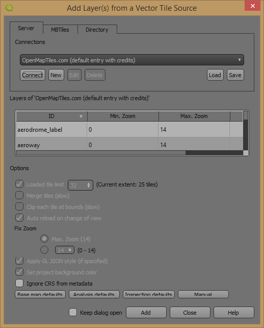
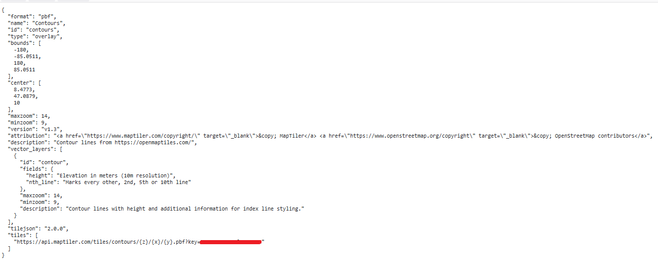
EDIT 2: I did more investigating, I think the QGIS plugin needs a capabilities document specifically looking like: enter image description here
2 Answers 2

1

You can build a tilejson that's a spec by mapbox and you can build GL JSON style sheet with resources like sprites,glyps and fonts.Thats what QGIS requires. Open layers has a extension/plugin for GL JSON styling for vector tiles. You can use several open source tools for building style sheets.

1

Assuming you have defined your service to output vector tiles the url for the tiles should be something like this:

http://pcpb620:8080/geoserver/gwc/service/wmts?REQUEST=GetTile&SERVICE=WMTS&VERSION=1.0.0&LAYER=belmap:buildings&TILEMATRIX=EPSG:4326:{z}&TILEMATRIXSET=EPSG:4326&FORMAT=application/vnd.mapbox-vector-tile&TILECOL={x}&TILEROW={y}

This type of URL should work in OpenLayers as well.

EDIT

It seems geoserver doesnt support outputing tilejson.
As @GeospatialInformationTech stated the implementations of tilejson are listed here.

You can however connect regular WFS, WMS and WMTS services from GeoServer to QGIS, for a WMTS source you can use a url like:

http://pcpb620:8080/geoserver/gwc/service/wmts?REQUEST=GetTile&SERVICE=WMTS&VERSION=1.0.0&LAYER=belmap:buildings&TILEMATRIX=EPSG:4326:{z}&TILEMATRIXSET=EPSG:4326&FORMAT=image/png&TILECOL={x}&TILEROW={y}
1
  • Thank you for the quick reply. This is indeed what I'm expecting for the actual request of the tiles. But the interface for the vector tile plugin seems to expect a sort of get capabilities (I'll add an overview of the interface in the description). I've tried adding the pcpb620:8080/geoserver/gwc/service/… in the url screens, but to no avail. The url itself does work and does show <Format>application/vnd.mapbox-vector-tile</Format> Commented Jun 25, 2019 at 13:03

Your Answer

By clicking “Post Your Answer”, you agree to our terms of service and acknowledge you have read our privacy policy.

Not the answer you're looking for? Browse other questions tagged or ask your own question.