4

After I have created a new QGIS project, the project CRS is set automatically to WGS84 (EPSG:4326 - WGS 84 - Geographic). The layer (.shp) which I loaded to the project has already a predefined CRS (also WGS84). I want to change the CRS to a projected CRS to make some calculations so I set the appropriate CRS both for the layer and for the project (EPSG:32632 - WGS 84 / UTM zone 32N – Projected). In the project properties (General Tab) WGS84 is set as the ellipsoid for distance and area calculations.

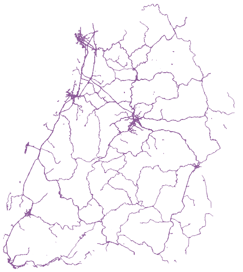
Although both the project and the layer(s) have exactly the same CRS, the layer is displayed in a geographical CRS (WGS84):

wgs84

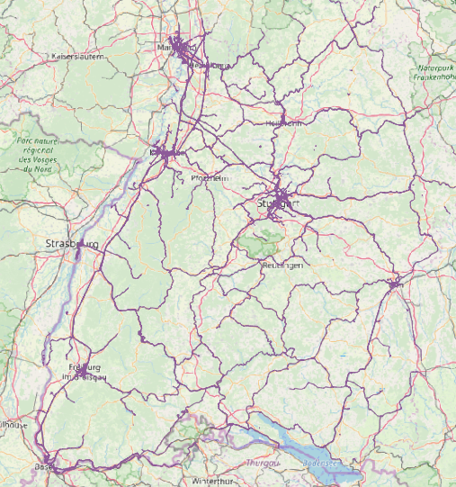
Changing the layer CRS back to WGS84 I actually get the correct display (as a projected CRS - UTM32N) although the layer CRS is wrong (WGS84):

utm32

To check the correct position I also loaded OSM as basemap. Using WGS84 I get the following result (exptected for UTM...):

project: WGS84

layer: WGS84

OSM basemap: WGS84

ellipsoid: WGS84

correct

while by:

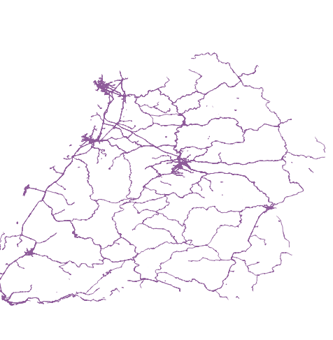
project: UTM32N

layer: UTM32N

OSM basemap: UTM32N

ellipsoid: WGS84 or GRS80

I am landing in the western coast of Middle Africa. enter image description here
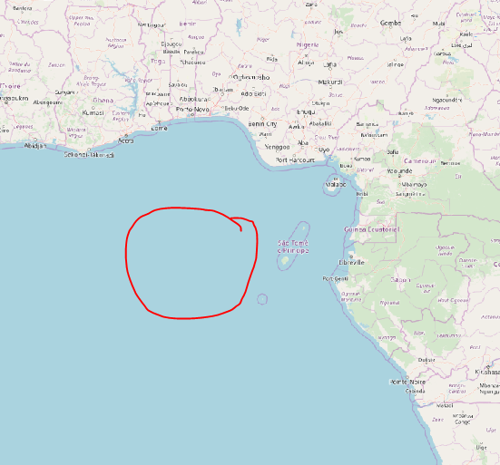
This is really annoying. Do I misunderstand anything generally regarding CRS settings in QGIS or what is the problem?

4
  • 7
    Don't change the crs of the layer, you must reproject the layer to change it.
    – Ian Turton
    Commented Oct 13, 2019 at 12:03
  • Looks to be located very near Null Island: en.wikipedia.org/wiki/Null_Island
    – meawoppl
    Commented Oct 14, 2019 at 7:31
  • I do have the same Problem. Did anyone find a solution to that?
    – B Sturm
    Commented Apr 1, 2020 at 13:52
  • @BSturm By reprojecting the layer and reloading it in the project you will get the appropriate projection of your layer (see answer).
    – Mapos
    Commented May 6, 2020 at 18:02

1 Answer 1

8

Following on Ian Turton's comment... Prior to performing ANY geometry calculations or analysis on a layer(s), the layer(s) MUST be 1) projected to the desired CRS, and 2) that CRS must be the same for all layers. (Sidenote #1: in QGIS, projecting a layer to a different CRS is typically accomplished using Save As...)

Your analysis will always fail if the above conditions are not met. Setting the project CRS only affects how the layers are screen displayed; any geometric calulations or analysis will be conducted on the layer(s) source CRS, NOT the project's CRS. (Sidenote #2: Geometric calculations or analysis are usually done with CRS values in feet or meters, not lat/long.

These requirements are software-agnostic.

1
  • I am aware that for geometry calculations a projected and not a geographical CRS must be used and that for each layer which is inculded in the calculations an identical CRS must be set. I was just wondering that altough I changed the layer CRS (via Saved Features as) I still got the wrong layer CRS (saved as UTM) and the project CRS was also in the same CRS (UTM). After I reprojected the appropriate layer the problem dissappeared. I suppose the problem is associated with the layer geometries. Using other layers (not from Geofabrik) they have been no problems with CRS. Thx nevertheless.
    – Mapos
    Commented Oct 18, 2019 at 12:25

Your Answer

By clicking “Post Your Answer”, you agree to our terms of service and acknowledge you have read our privacy policy.

Not the answer you're looking for? Browse other questions tagged or ask your own question.