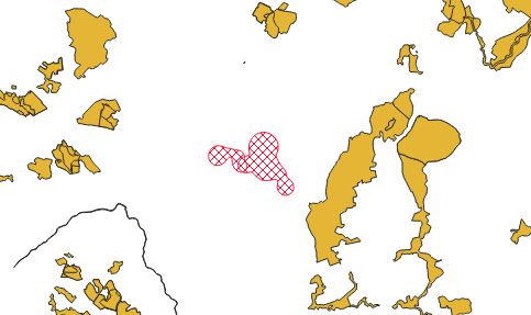
I have tracking data from multiple animals and I have created kernel density estimates of their home ranges. I want to find out the proportion of each home range area that falls within protected areas. I'm using the adehabitatHR package to calculate the home ranges and the wdpar package to download the protected areas from the World Database on Protected Areas. But I'm not sure how to link the two to calculate the proportion of overlap. Here's an example of the code I have so far:
library(amt)
library(wdpar)
library(rgdal)
library(adehabitatHR)

data(deer)
mini_deer <- deer[1:100, ]
mini_deer$id <- ifelse(mini_deer$x_ < 4313000, "A", "B")

mini_deer <-
  mk_track(
    mini_deer,
    .x = x_,
    .y = y_,
    .t = t_,
    id = id,
    crs = CRS(
      "+init=epsg:3035 +proj=laea +lat_0=52 +lon_0=10 +x_0=4321000 +y_0=3210000 +ellps=GRS80 +towgs84=0,0,0,0,0,0,0 +units=m +no_defs"
    )
)

# Keep only the id column and the x and y coordinates
mydata.sp <- mini_deer[, c("id", "x_", "y_")]
coordinates(mydata.sp) <- c("x_", "y_")

# kde
kernel.ref <- kernelUD(mydata.sp, h = "href")  # href = the reference bandwidth
mydata.kernel.poly <- getverticeshr(kernel.ref, percent = 95, unout = "m2")
print(mydata.kernel.poly)  # returns the area of each polygon

# get the protected area data
ger_raw_data <- wdpa_fetch("Germany", wait = TRUE)
pa_data <- st_transform(ger_raw_data, 3035)

# scene missing
# proportion of overlap for A and B


rappdirs::user_data_dir("wdpar")which you might want to clean up afterwards.