I have 3 global images of land cover (300m spatial resolution). I simply want to clip each land cover image into 3 different regions (9 total). I also want to reclassify the images.
The way I would usually do it is to repeat the code per desired output using .clip(), .remap() and Export.image.toDrive(). To know exactly what I want to achieve, see Part 1; lines 1-90. However, I keep getting the error; "User memory limit exceeded." I am not sure why, maybe the region is too big?
Nonetheless, I now want to loop over the whole process to make the code more efficient. I attempt a "loop" in Part 2; lines 91-134. I insert the code for the loop here.
//  Load vector boundary
var pantropics = ee.FeatureCollection('users/jjohanness1992/ESA_Equatorial_Tropics/boundary_pantropics');

//  Define start and end value for vector layer attribute 'label'
var start_region = 1;
var end_region = 3;
//  label = 1 (Americas), label = 2 (Australasia), label = 3 (Africa)

//  Load images
var esa1995 = ee.Image('users/jjohanness1992/ESA_1992_to_2018/ESA1995');
var esa2000 = ee.Image('users/jjohanness1992/ESA_1992_to_2018/ESA2000');
var esa2005 = ee.Image('users/jjohanness1992/ESA_1992_to_2018/ESA2005');

//  Prepare image reclassification codes
var oldgroup = ee.List([0,10,11,12,20,30,40,50,60,61,62,70,71,72,80,81,82,90,100,110,120,121,122,130,140,150,151,152,153,160,170,180,190,200,201,202,210,220]);
var newgroup = ee.List([0,1,1,1,1,1,1,2,2,2,2,2,2,2,2,2,2,2,3,3,3,3,3,4,4,5,5,5,5,6,6,6,7,8,8,8,9,10]);

//  Perform 'loop' operation
var i;
  for (i=0;i<=2;i++){
    var imagestack = ee.List([esa1995,esa2000,esa2005]);
    var year_dict = ee.Dictionary({
      '0':'1995',
      '1':'2000',
      '2':'2005'
    });
    var year_string = year_dict.get(ee.Number(i).format()).getInfo();
var j;
  for (j=start_region;j<=end_region;j++){
    var region = pantropics.filter(ee.Filter.eq('label', 'j'));
    var imagexregion = ee.Image(imagestack.get(i))
    .clip(region).remap(oldgroup,newgroup);
    var region_string = ee.Number(j).format().getInfo();
Export.image.toDrive({
  image:imagexregion.uint8(),
  description:'esa-'+region_string+'-'+year_string,
  folder:'esa-loop-test',
  region:region,
  scale:300,
  crs:'EPSG:4326',
  maxPixels:1e13,
  fileFormat:'GeoTIFF'});
  }
}
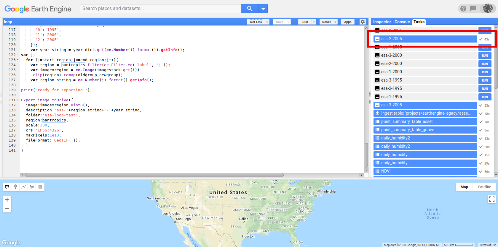
However, I cannot get my "loop" to run. After running the task in the 'Tasks' tab, it turns red after a ~30 seconds, with the following error message; "Error: Image.clipToBoundsAndScale: The geometry for image clipping must not be empty.". Please find my GEE script here.
I find this weird because firstly, I used .clip() not .clipToBoundsAndScale(). This is because I do not want the image to be clipped to the bounding box of the regions, I want them clipped to the exact region boundary. Secondly, this error message means that the regions are not identified, or are blank, which is why the clipping cannot be conducted. Unless .clip() is wrong and I should be using .clipToBoundsAndScale({geometry:region,scale:300}) instead.
Maybe I am wrongly using some functions in my code.
Edit:
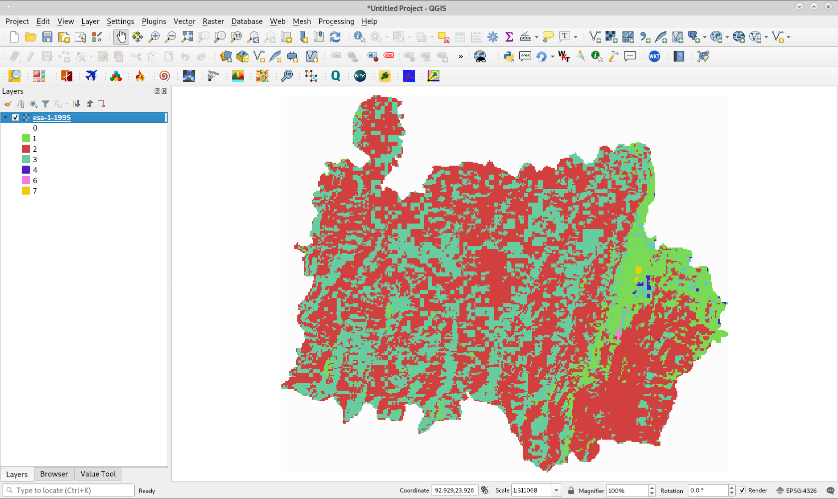
The pantropics asset took up ~64 Mb in GEE space. I exported it to Google Drive to inspect it. The Shapefile is now ~124 Mb, and when previewed in QGIS, looks fine. The only difference is that previously, the Shapefile had only 3 dissolved regions for Americas, Africa and Australasia, but this export has 12 features in total. See picture for comparison (maybe the geographical region was too big, and GEE had to segment it into these 12 smaller subregions).
I re-ingest this new asset into GEE, and re-run the loop. Although the code looks like it runs, as tasks are being created in the Tasks tab, after some time, the browser crashes.


