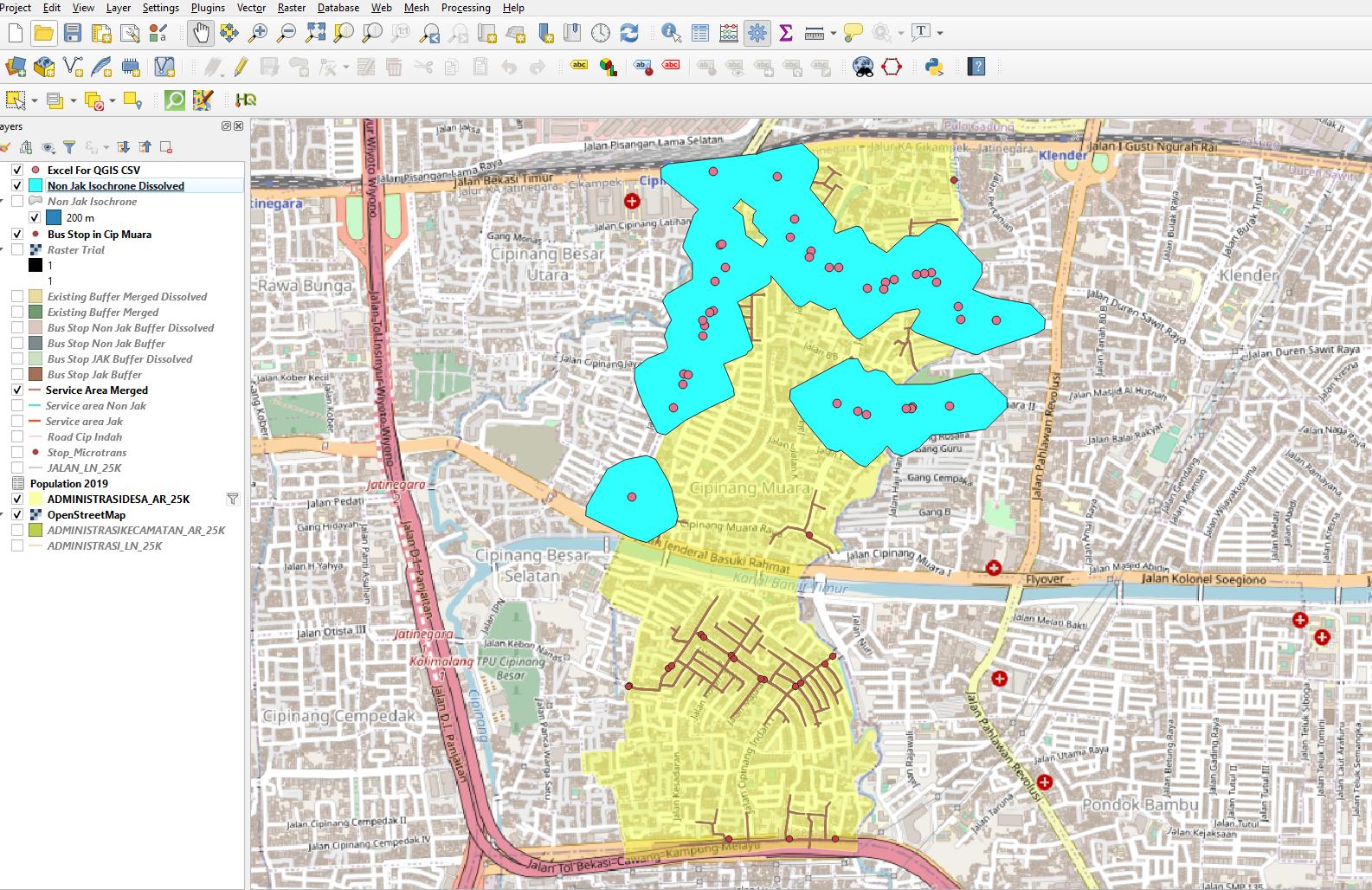
So I made an isochrone using ORS Tools plugin, as well as using the Network analysis toolbox to analyze the service area of the bus stop. Ultimately I want to provide a statement of X% Area covered from the bus stops. So to do that I need the area of the service area of the bus stops divided by the area of the district (The yellow shapefile layer). It'll be easier to calculate the area if I use isochrones from the ORS Tools plugin, but it went beyond the district itself making the Service Area/District Area formula questionable, meanwhile, the network analysis toolbox is perfectly bounded inside the district layer but it's impossible to calculate its area since it's counted as a line vector.
So is there any method to keep the isochrone under the boundary of the district shapefile layer? Or is there any method to turn the service area lines into polygons to calculate its area?

