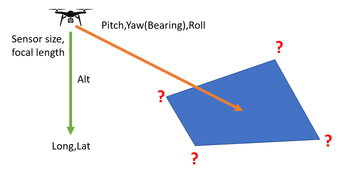
Looking for an algorithm (python, formulas, whatever...) to georeference a single drone image based on its EXIF data.
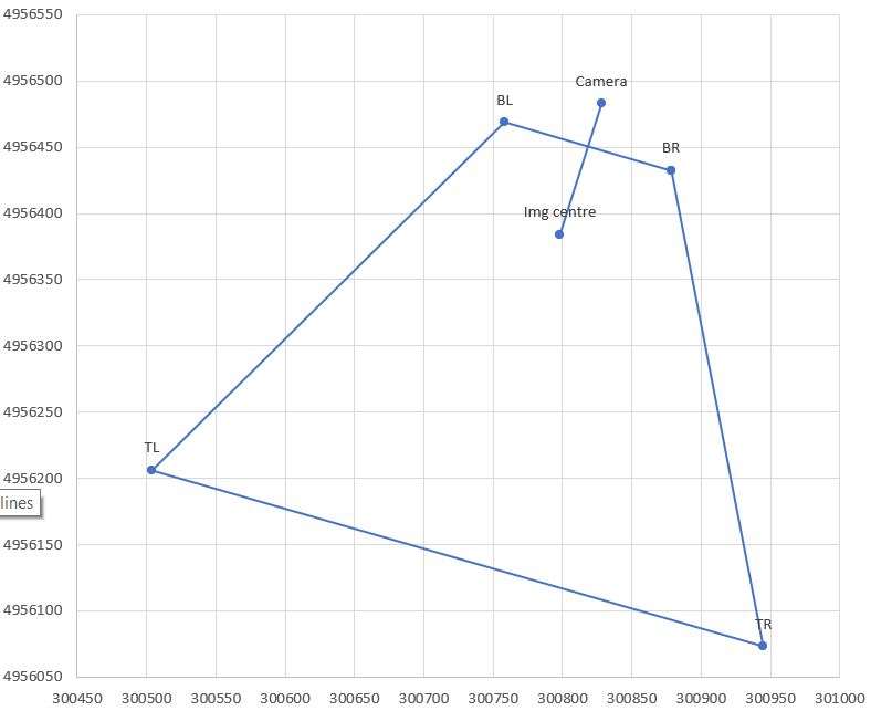
Specifically, I need to translate drone GPS latitude and longitude (after conversion to projected coordinates, of course), relative altitude, drone camera orientation (pitch, roll, yaw), and drone sensor parameters (sensor size and focal length) to ground coordinates of the centre and four corners of the drone image.
I'm comfortable assuming flat terrain, so this would be independent of the DEM, and recognize measured GPS coordinates will have imprecisions affecting the results too.
I'm aware that commercial UAV mapping software and services, such as Pix4D, DroneDeploy, and MapsMadeEasy.com, solve the much more complicated problem of stitching many such images together and extracting 3D terrain information, including dealing with those imprecisions. I'm looking to solve the much simpler problem of "what is this one image looking at, more or less".
Based on Getting coordinates of pixel from georeferenced drone photo?, I've also started looking at literature about "monophotogrammetry" and "monoplotting" (example: https://www.wsl.ch/en/services-and-products/software-websites-and-apps/monoplotting-tool.html), but the emphasis seems to be on interpolation of features/lines on the photo after manually identifying GCPs. In this context, I'm after the math to approximately but automatically identify the corners only.
I've dusted off my geometry and trigonometry knowledge, and can do simple cases with simple formulas. For instance, ignoring roll and yaw, the centre of the photo is (I think!) the following distance in front of the drone's GPS location, and likewise the horizontal field of view at the centre:
fwd_dist_img_ctr = altitude * tan(-pitch)
ground_fov_img_ctr = hypotenuse(altitude,fwd_dist_img_ctr) * sensor_width / focal_length
I'm hoping for leads how to extend this to a) the four corners of the image, and b) incorporating roll and yaw, and therefore camera direction (bearing) too.
Adding: seems this is embedded in GRASS' i.ortho.photo (https://grass.osgeo.org/grass78/manuals/i.ortho.photo.html), but buried behind a GUI focused on GCPs, correction, and stitching a map from multiple photos. I'm looking for the minimally complicated math to do it automatically, per single image.
Eventually, this will be used to visualize a layer of research drone photos on a map by the ground footprint displayed, rather than by GPS location of the drone/sensor itself. Probably as a processing algorithm in QGIS after extracting all of the pertinent EXIF tags as attributes.


camera.transform.mulp(sensor.calibration.unproject(...)), which I'm guessing is a part of AgiSoft's proprietary API? Or do you know where to find that code by any chance? (I failed with a quick google search)