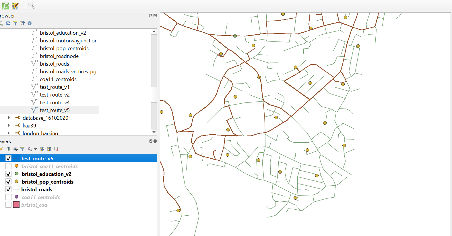
I have been working with a set of data which mimics a shortest distance 'many to many' network analysis between COA population weighted centroids and education points in Bristol. My population centroids have been snapped to the road network, and I have tried various distance threshold within this section of code
-- ###
UPDATE bristol_coa11_centroids SET id = br.id
FROM bristol_roads_vertices_pgr br
WHERE ST_DWithin(bristol_coa11_centroids.geom, br.geom, 0.001);
-- ###
SELECT *
INTO test_route_v5
FROM pgr_dijkstra(
    'SELECT gid as id, source, target, length:: double precision AS cost
        FROM bristol_roads',
    ARRAY(SELECT id from bristol_coa11_centroids),
    ARRAY(SELECT id from bristol_education_v2), false) as be
    LEFT JOIN bristol_roads AS br ON be.edge = br.gid
    ORDER BY be.seq;

SELECT * FROM test_route_v5;
However, I have noticed that routes aren't being generated from all of the centroids (see image). Is there a way to get round this in Postgres or Arcmap first? I have measured distances from centroids and roads and determined different threshold against that but have seen no change. I need to expand the study size area so cannot afford to have a magnitude of points being missing. Thankyou!

