If you want to use QGIS, you can easily define a custom projection, based on an existing projection. Let's say you want to use EPSG:4326 (WGS 84) with prime meridian shifted from Greenwich to 90° East. This solution works the same way for modifying other projections as well.
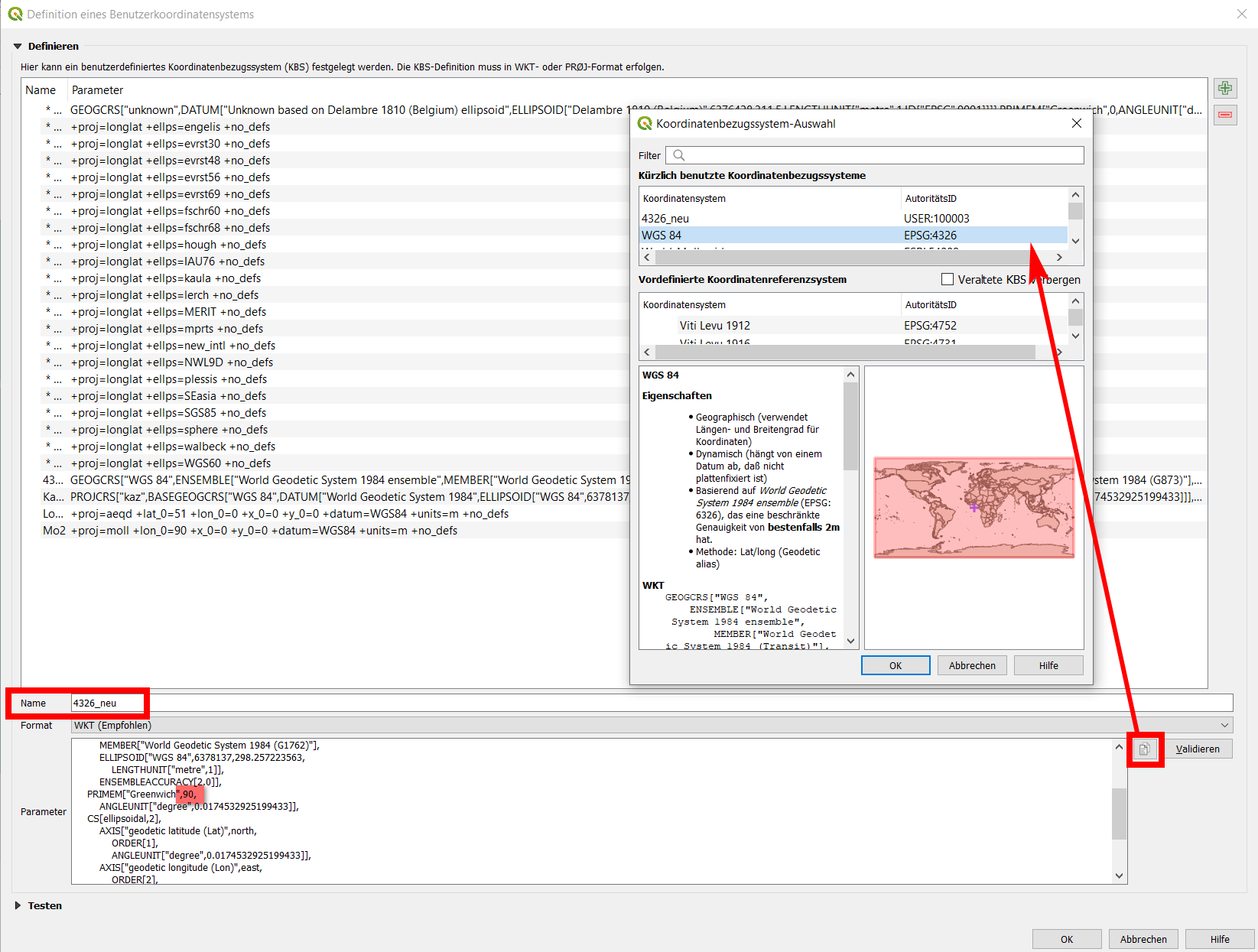
Open Menu Settings / Custom Projections… and click Copy parameters from existing CRS - the small copy-icon on the right, see red box in the screenshot:
Custom projection dialog: here, the values were already modified to PRIMEM["Greenwich",90,. In the textbox name, define a name for the custom CRS so that you can easily recognize it:

Select the existing CRS you want to modify, here EPSG:4326. In the line saying PRIMEM["Greenwich",0, (highlighted in red), replace 0 by 90:
PRIMEM["Greenwich",90,
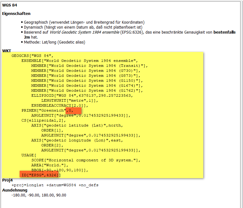
Then go to the last line and delete ID["EPSG",4326] (the last, final closing square bracket ] should remain).
Screenshot: this is how the original EPSG:4326 WKT-definition looks like. Highlighted in red where you have to make your changes:

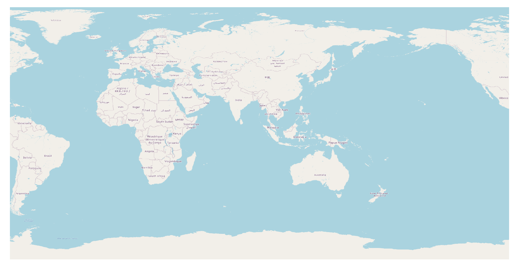
And that's how the result looks like:


