3

Esri just released a global 10m land cover file. It is being served as an image server here https://tiledimageservices.arcgis.com/P3ePLMYs2RVChkJx/arcgis/rest/services/Esri_2020_Land_Cover_V2/ImageServer

I tried loading it through both XYZ tiles as well as Vector tiles, but it would not load. The ArcGIS Image Server Connector doesn't work as well.

Is it possible to load it in QGIS?

5
  • I get an error too Network error: Error transferring https://tiledimageservices.arcgis.com/P3ePLMYs2RVChkJx/arcgis/rest/services/Esri_2020_Land_Cover_V2/ImageServer/exportImage?bbox=147.395373,-32.967981,147.624287,-32.848698&size=1592,830&format=jpg&layers=show:&transparent=true&f=image - server replied: Bad Request
    – BJW
    Commented Jun 27, 2021 at 0:31
  • Have you added it as ArcGIS REST Service? It will not work like that, because it is not a MapServer, exportImage is for MapServer Commented Jun 27, 2021 at 9:14
  • 1
    Go to arcgis.com/apps/instant/media/… Click on one tile to get a TIFF URL and add it to QGIS and you're done. No issue with access PS: I think url provided by @alex was fine at a moment but broken and changed
    – ThomasG77
    Commented Jul 1, 2021 at 10:47
  • @ThomasG77 Can you also access them via Azure Blob Storage option in QIGS and would that make a difference on speed. I tried accessing via Azure Blob but can't figure out what's bucket and key in the url. Maybe it is not a Azure Storage File but looks like it is. Commented Jul 3, 2021 at 22:43
  • See my answer. FYI, I consume directly remote Geotiff (good bandwidth needed)
    – ThomasG77
    Commented Jul 3, 2021 at 23:34

3 Answers 3

2

I've added as an ArcGIS Feature Service the following URL https://services.arcgis.com/P3ePLMYs2RVChkJx/arcgis/rest/services/LULC_2020_Download_Scenes/FeatureServer

Then, I know to consume remote URL, I can in an action say "display me a tile from a raster" as long as I get a vector coverage grid to get the infos from. The raster can be local or remote. You can learn from https://www.youtube.com/watch?v=8rOe-9A84O8 for an example of action to consume local tif using a grid. It's what I do with the following Python code in an action on the layer from above ArcGIS Feature Service

from qgis.utils import iface

baseurl = 'https://ai4edataeuwest.blob.core.windows.net/io-lulc/io-lulc-model-001-v01-composite-v03-supercell-v02-clip-v01/'
filename = "[% "Filename" %]"
path = f"/vsicurl/{baseurl}{filename}"
iface.addRasterLayer(path)

Below, a screenshot of the action
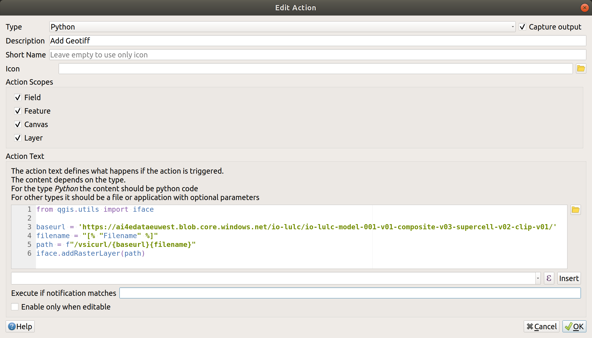
enter image description here

Then, you can get the image by using the action as shown below (need to select the vector layer and right click on a cell of the grid with toolbar button "Identify Features" selected
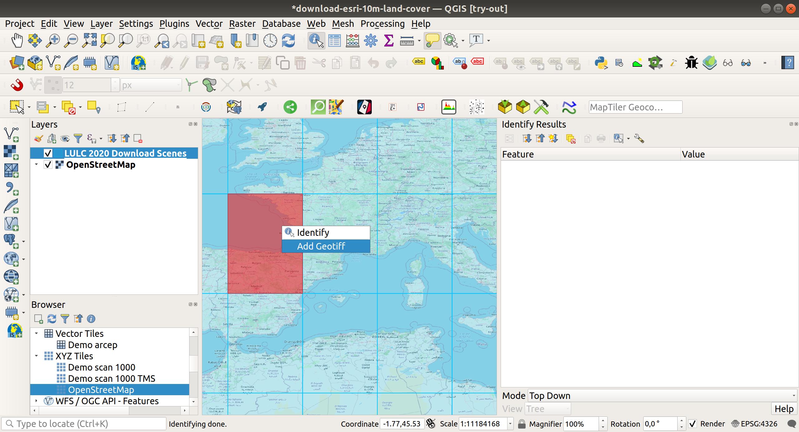
enter image description here

Be aware we need a good bandwidth as we directly consume remotely the Geotiff. You could also download them if you change some code in the action. In this case, look at https://github.com/ThomasG77/qgis-as-a-download-service for an illustration project. It's not intended for the same data but you can borrow the logic.

You can download a QGIS standalone project from a Gist and open it to see and use the end result.

1

These files are available at GeoTIFFs.

I created a list over here

And someone else created a STAC Catalog here.

Basically there's a bunch of files at URLs like: https://ai4edataeuwest.blob.core.windows.net/io-lulc/io-lulc-model-001-v01-composite-v03-supercell-v02-clip-v01/01C_20200101-20210101.tif

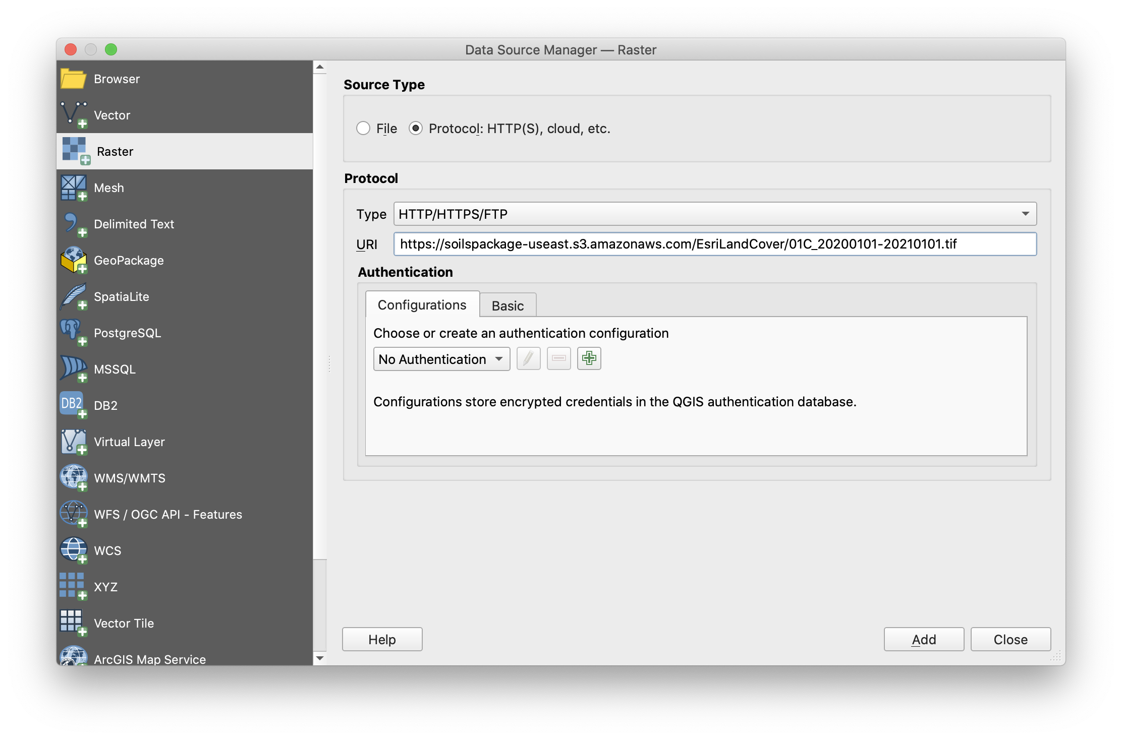
And you can coy and paste that URL into QGIS's "Add Raster" dialog in the "HTTP" protocol source, like so:

enter image description here

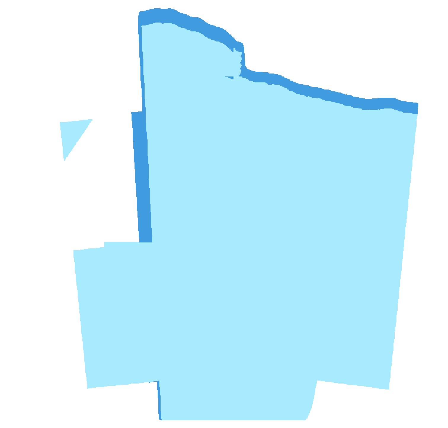
It even has an embedded colour table, although, the tile I linked above is just ice and water...

enter image description here

2
  • (In response to Alex's message) Somehow, when I try to download the following, I get an "Access Denied". soilspackage-useast.s3.amazonaws.com/EsriLandCover/… Thank you Murat
    – Murat Isik
    Commented Jul 1, 2021 at 10:04
  • Thanks for the answer and it is helpful but I am looking for a more direct way to load ESRI Image service to QGIS, particularly this one. Commented Jul 1, 2021 at 12:30
0

Also there is a direct download here https://www.arcgis.com/apps/instant/media/index.html?appid=fc92d38533d440078f17678ebc20e8e2

Your Answer

By clicking “Post Your Answer”, you agree to our terms of service and acknowledge you have read our privacy policy.

Not the answer you're looking for? Browse other questions tagged or ask your own question.